


The Basics
Albert Pike Recreation Area
AR Highway 369
Langley, AR
Phone: (870) 356-4186 (Caddo District Office)
Closest Towns: Daisy, Glenwood, Langley
Directions: Albert Pike Rec Area is located approx. 5.8 miles north of Langley on AR Hwy 369.
About Albert Pike
**Special Notice**
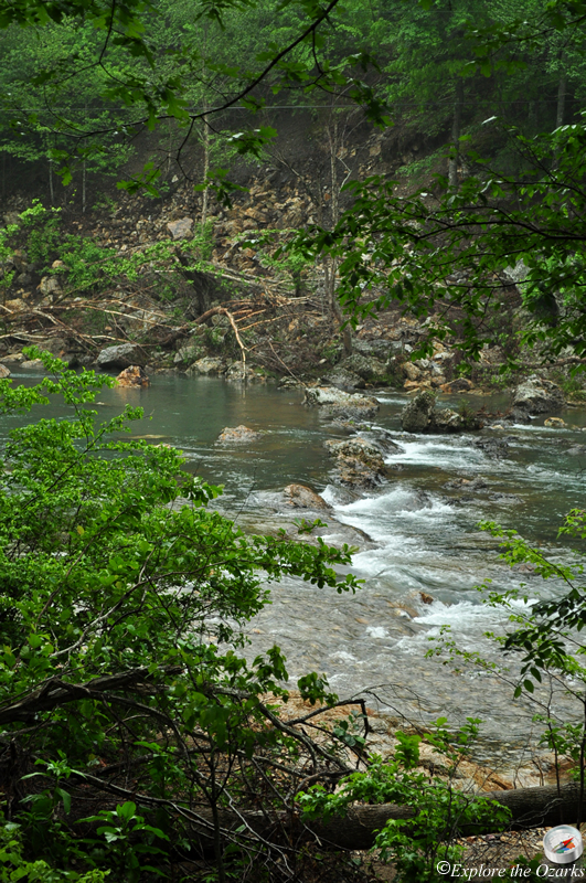
In June of 2010, the Albert Pike Recreation Area suffered extensive damage from a major flash flood. Since then, the recreation area has been closed to public use. In May of 2012, portions of the area have been re-opened for day use only. Camping areas are still not available at this time, and remain closed until further notice. For questions concerning the future of the Albert Pike Recreation Area, please contact the Caddo Ranger District Office of the Ouachita National Forest,
at (870) 356-4186.
***
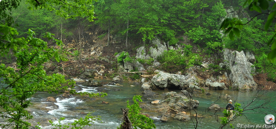
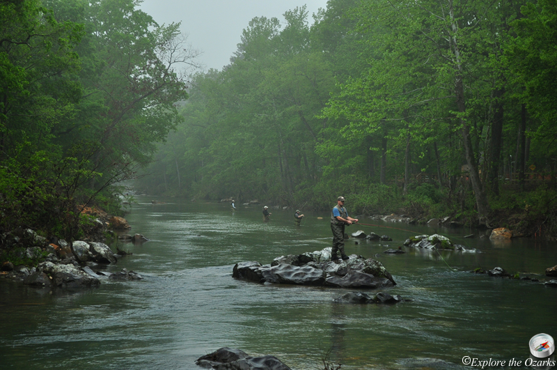
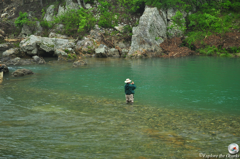
Nestled on the southern edge of the Ouachita Mountains west of Hot Springs, the Albert Pike Recreation Area is a remote campground and day use facility, situated along the beautiful Little Missouri River. The area is popular with campers, hikers and floaters alike.
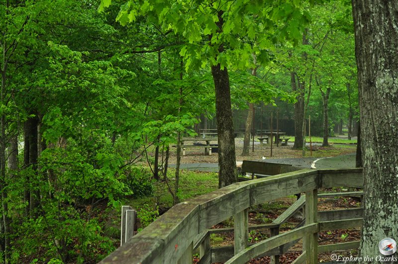
Facilities include numerous campsites, restrooms, a swimming area, picnic sites, floating access and hiking trails.
The campground offers 54 campsites, mostly primitive with no hookups. There are eight campsites in Area D that do offer electric and water hookups. Each site offers a table and grill. Most campsites can accomodate smaller RVs and camping trailers, but sites outside of Area D do not offer any hookups or utilities. Restrooms with flush toilets and hot showers (in-season) are provided. A dump station is also provided.
Areas A & B are located in the day use portion of the recreation area, and offer numerous picnic sites, river access for swimming and/or floating, and access to hiking trails.
Two trails are accessible from the recreation area, the 1 mile Bluff Mountain Hiking Trail, and the 15 mile Little Missouri Hikig Trail. The Bluff Mtn Trail takes off from the campground at Area C, and tours the immediate surrounding Ouachita Mountains and National Forest north of the area. The 15 mile Little Missouri Trail passes through the recreation area, and can be hiked from here in either direction. The portion of the trail that travels downstream from the rec area passes through an area known as the winding stairs, and offers beautiful views of the surrounding forest, river valley, and numerous rock features. The trail crosses the Little Missouri River numerous times, and has some steep sections. The section that travels upstream is more level, and eventually works its way to Little Missouri Falls. It is one the most popular trails in the Ouachita National Forest. The Little Missouri Trail is also part of the Eagle Rock Loop, which combines this trail with the Athens-Big Fork Trail and the Viles Branch Horse Trail, and is the longest loop trail in Arkansas.
Starting at the Albert Pike Recreation Area, floaters can canoe 20 miles of the Little Missouri River down to the Highway 70 bridge near Lake Greeson. The float is typically divided into two sections; from Albert Pike to the Highway 84 bridge, which is 8.5 miles; and from the Highway 84 bridge to the Highway 70 bridge, a distance of 11.5 miles.
Most of the floatable section of the river offers twisting drops, cascades, up to Class IV rapids, and large standing waves. Floating conditions depend upon suitable amounts of rainfall, and can offer a challenge that is recommended for experienced paddlers only. As the river leaves the Ouachita Mountains as it travels south, the river becomes slower and ends surrounded by much flatter terrain.
The Little Missouri River is also popular with fisherman, and offers trout, bream and smallmouth bass.
What's Nearby
Parks & Nature
Daisy State Park
Trails
Bear Creek Cycle Trail
Camping
Daisy State Park Campground
Lodging
Local Eateries
Gear & Supplies
Other Attractions
Crooked Creek Falls
Little Missouri Falls
Towns & Cities