


The Basics
- Height: 95'
- GPS: N35 07.289, W92 56.046
- USGS Quad: Adona
- Distance: 1 mile One-Way
- Difficulty: Moderate Hike
- Location: Petit Jean State Park
- Region: Arkansas River Valley & Ouachita Mtns
Details & Directions
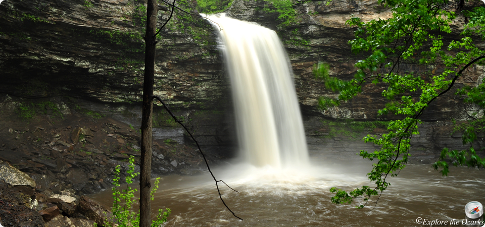
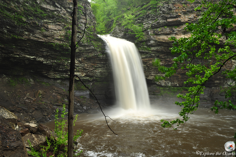
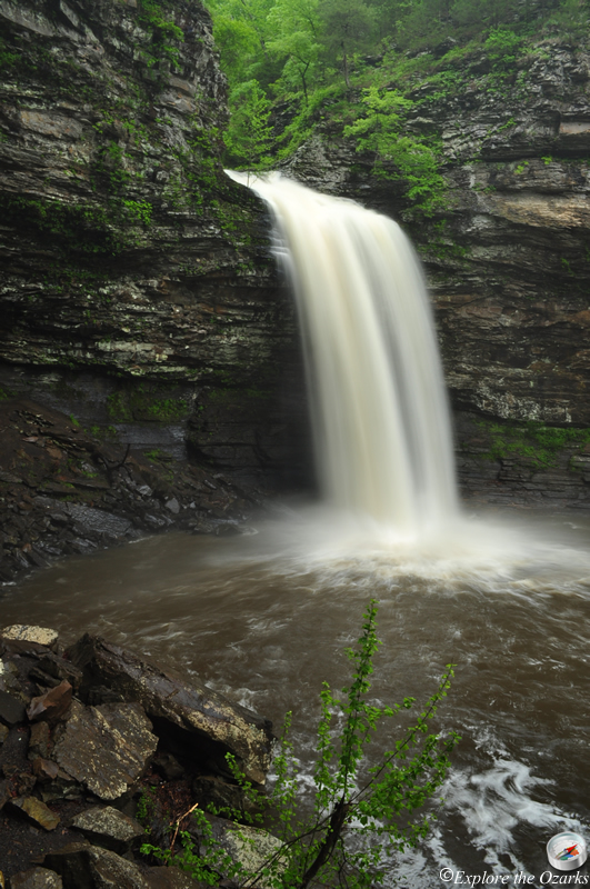
This is one of the most popular waterfalls in Arkansas, and you will see many pictures of it to promote Petit Jean SP and Arkansas State Parks in general. It is highly photographed and highly visited, and with good reason. There are two ways to view these falls once you are inside the park. A handicap-accessible boardwalk leads to a viewing platform from above, or you can take the Cedar Falls Trail down to the base of the falls. The hike back out can be a little steep, but not too much of a problem for most people.
The Cedar Falls Trail begins at the Mather Lodge, and this is where you will park, too. The trail begins to switchback downhill at the beginning, passing by a nice little drainage on your left; there may be a small waterfall here if it has been raining alot. Once the trail finally gets to the bottom, it levels out a bit, then crosses Cedar Creek on a narrow bridge. Once you cross the bridge, Turn Right, and the trail will follow the creek upstream all the way to the falls. Be sure to rest for the climb back out!