


The Basics
Brock Creek Lake Recreation Area
Jerusalem, AR
Phone: (479) 284-3150 (Big Piney District Office)
Brochure: Brock Creek Trails (courtesy USFS)
Closest Towns: Jerusalem, Morrilton, Russellville
Directions: Austin Trailhead: From Jersualem, follow CR# 32 north (gravel, turns into FR# 1305/Cheyenne Rd.) approx. 11 miles, then Stay Right/Merge onto CR# 1/White Oak Mtn Rd. Go 0.4 mile, then Turn Right onto CR# 2/Wilderness Trail Rd. The trailhead will be approx. 2.9 miles on your right down CR# 2.
Brock Creek Campground/Trailhead: From Jersualem, follow CR# 32 north (gravel, turns into FR# 1305/Cheyenne Rd.) approx. 6 miles. Turn Right/East onto CR# 224/FR# 1309/Rock Creek Rd and go 0.1 mile, then continue Straight/Turn Left onto CR# 226/FR# 1331/Bell Rd. Go approx. 0.7 mile to the campground entrance on your right.
Mountain Man Trailhead: From Jersualem, follow CR# 32 north (gravel, turns into FR# 1305/Cheyenne Rd.) approx. 10.3 miles to the trailhead on your right. (About 0.2 miles past FR# 1331/Charleston Rd)
Zing Trailhead: From Jersualem, follow CR# 32 north (gravel, turns into FR# 1305/Cheyenne Rd.) approx. 10.1 miles to FR# 1331/Charleston Rd. Turn Right and go approx. 1.9 miles to the trailhead on your right.
About Brock Creek Lake
Situated in the remote southeast corner of the Ozark National Forest, the Brock Creek Lake Trail System offers over 40 miles of trails for ATVs, dirtbikes, Off-Highway Vehicles (OHV), mountain bikes, hikers and horseback riders. The trails work their way through typical Ozarks oak/hickory and pine forests, and traverse small streams and creeks, switching from valley bottoms to high ridge tops. The area offers trails for all skill levels of riders.
Composed of two major loops, with many interconnecting loops, Brock Creek Lake Trail System offers at least 42 miles of riding opportunities. The two loops, named the Mountain Man Trail and the Jeep Trail, each offer different types of trail for different types of off road use.
The Mountain Man Trail is designed primarily as a single track system, specifically for dirt bikes. However, mountain bikers, hikers and equestrain riders may use the trails as well. The trails are marked with yellow diamonds. The main trailhead for this section is the Zing trailhead, but trails can also be accessed from the Mountain Man Trailhead or the Austin trailhead. Camping is not allowed at any of these trailheads.
The Jeep trail is a series of double track trails designed for ATVs and OHVs, but can also be used by dirt bikes, equestrian riders, mountain bikers and hikers. The Zing trailhead is the primary trailhead for these trails, but they can also be accessed from the Brock Creek Lake Campground. Trails are marked in orange diamonds, and mostly follow old forest roads. Many of the connecting trails cross steep slopes, providing for a greater challenge and requiring a higher skill level.
High clearance OHVs, such as jeeps, may only use trail numbers 42 and 51. The north end of trail #42 may be accessed from the Autsin trailhead, and the south end can be reached from CR# 423/Charleston Rd. The southern end of trail #51 can be accessed from FR# 1331 near the Brock Creek Lake Dam.
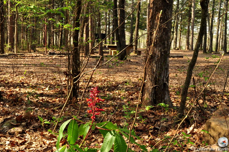
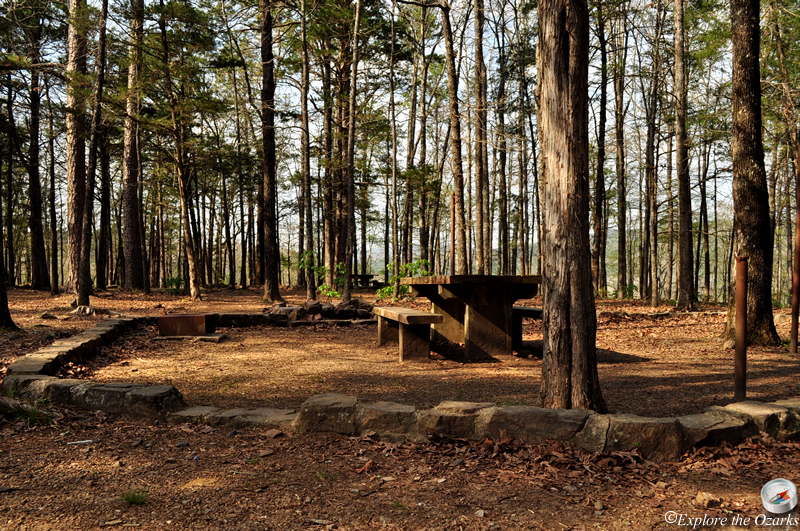
Located at the Brock Creek Lake Trailhead, the campground offers six primitive sites with picnic tables, fire rings and lantern posts. No water or electric hookups area available, but there is a vault toilet located at the campground.
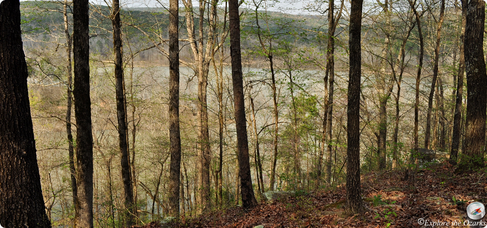
The area takes its name from the approx. 30-acre sized Brock Creek Lake, built many years ago for flood control on Brock Creek. Fishing is good in Brock Creek Lake, and a primitive boat ramp offers access for small boats.
What's Nearby
Parks & Nature
Trails
Camping
Lodging
Local Eateries
Gear & Supplies
Other Attractions
Towns & Cities