


The Basics
- Height: 24'
- GPS: N35 51.089, W93 07.447
- USGS Quad: Lurton
- Distance: 0.4 miles One-Way
- Difficulty: Easy Bushwack
- Location: Ozark National Forest
- Ranger District: Big Piney
- Region: Arkansas Ozarks & Boston Mountains
Details & Directions
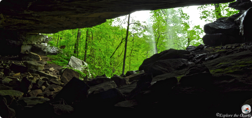
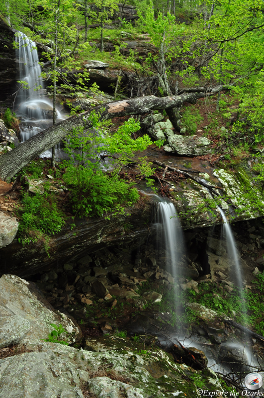
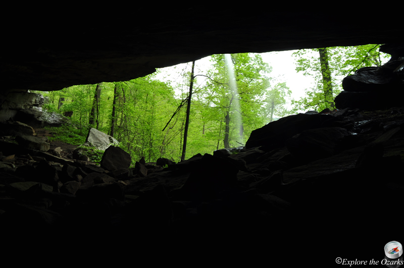
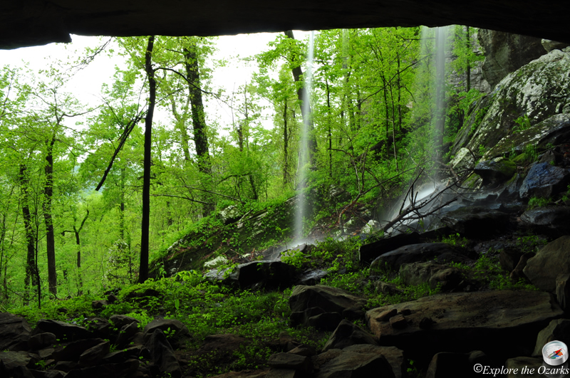
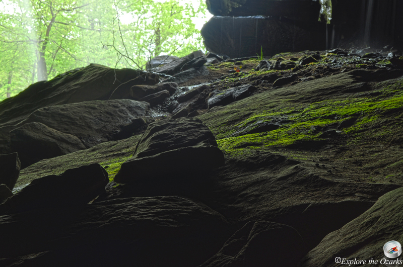
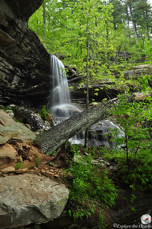
This waterfall, located in the Ozark National Forest, pours over one of the deepest bluff shelters in the Ozarks. Hudson Shelter, which goes back about 75 feet into the bluff, offers a nice level spot to relax, but please remember that digging and collecting of artifacts in the National Forests is prohibited. There is no trail to the waterfall, but it is a short, easy bushwack.
To get here, travel south on AR Scenic Highway 7 out of Jasper for about 14 miles, until the intersection with AR Hwy 16. Continue South on AR Hwy 7/16 for 2.9 miles to Cowell, and then Turn Left onto FR#1204/CR#55 (gravel). Go 4.2 miles and then Turn Right onto FR#1204-B. Jusy go about 100 yards or so and park on the side of the road where an old roadbed takes off on the Right.
Follow the old roadbed about 100 yds or so, and when it begins to swing back to the left, Leave the old roadbed to the Right, bushwacking straight down the hill. There will be two small creeks, one on your left and one on your right, then they will come together. Follow them downstream, keeping the stream to your right. The upper portion of the falls will be just a few hundred yards further. Be careful if you try and make your way down to the lower falls and the shelter.