


The Basics
- Height: 114'
- GPS: N35 43.488, W93 01.507
- USGS Quad: Sands Gap
- Distance: 1.9 mile Loop
- Difficulty: Easy Hike
- Location: Ozark National Forest
- Ranger District: Big Piney
- Sub-Location: Pedestal Rocks Scenic Area
- Region: Arkansas Ozarks & Boston Mountains
Details & Directions
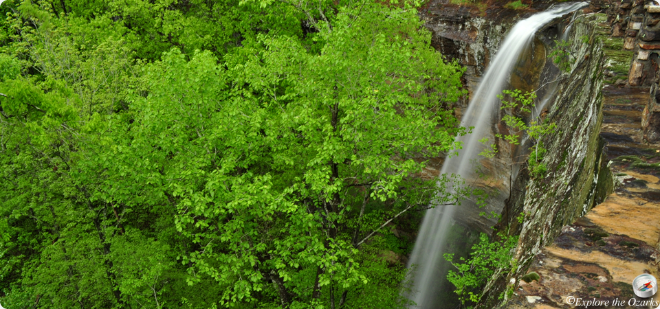
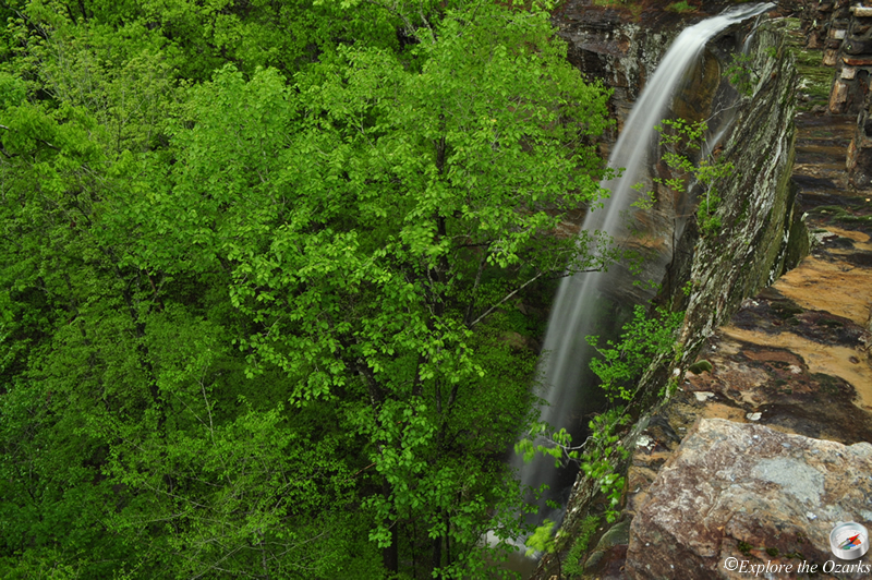
One of the tallest in the Ozarks, this waterfall pours from atop the impressive Kings Bluff, which is located in the Pedestal Rocks Scenic Area. The large bluffs in the area offer many geologic formations to view. There is a railing atop the highest bluff, near the waterfall, but caution is still advised; the top of the bluff can be very slick when wet. If you decide to bring along your kids, please hold on to them at all times!
To get here, travel east on AR Hwy 16 from AR Scenic Hwy 7 at Pelsor (between Jasper and Russellville). Go about 6 miles and look for a sign into the area on your Right. If you reach Ben Hur, go back about 2½ miles. This is a day use only area, so no camping is allowed, but a restroom and picnic table are provided.
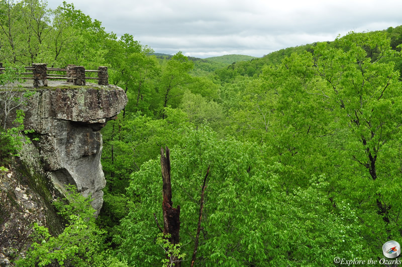
As you begin down the trail, you will cross a stone bridge, then come to a trail intersection. The path straight ahead leads to Pedestal Rocks, but we want to Turn Right and head down the Kings Bluff Loop Trail. The first part of this trail follows an old roadbed, going slightly uphill, but then eventually turns into a regular hiking trail. After a few switchbacks, you will come out to the top of Kings Bluff at the 1 mile point. Stay a while, and enjoy the view!
From the top of the bluff, the trail continues to the left, and follows along a very scenic bluffline. The trail continues towards the top of the bluff on your left, and offers great views to your right. It then gradually makes it way back up through the forest, coming to an intersection with the 2.6 mile Pedestal Rock Loop Trail. You can turn right or continue straight to visit the scenic area, or Turn Left to return to the trailhead.