


The Basics
- Height: 6'
- GPS: N35 45.716, W92 56.252
- USGS Quad: Moore
- Distance: 100'
- Difficulty: Easy
- Location: Ozark National Forest
- Ranger District: Big Piney
- Sub-Location: Richland Creek Wilderness
- Region: Arkansas Ozarks & Boston Mountains
Details & Directions
Here are five neat waterfalls along a short length of road next to Falling Water Creek, and just a few miles north of Falling Water Falls. This road and Falling Water Creek skirt the edge of the Richland Creek Wilderness, which is full of many other waterfalls and scenic treasures. All of these falls are just a few miles south of the Richland Creek Campground.
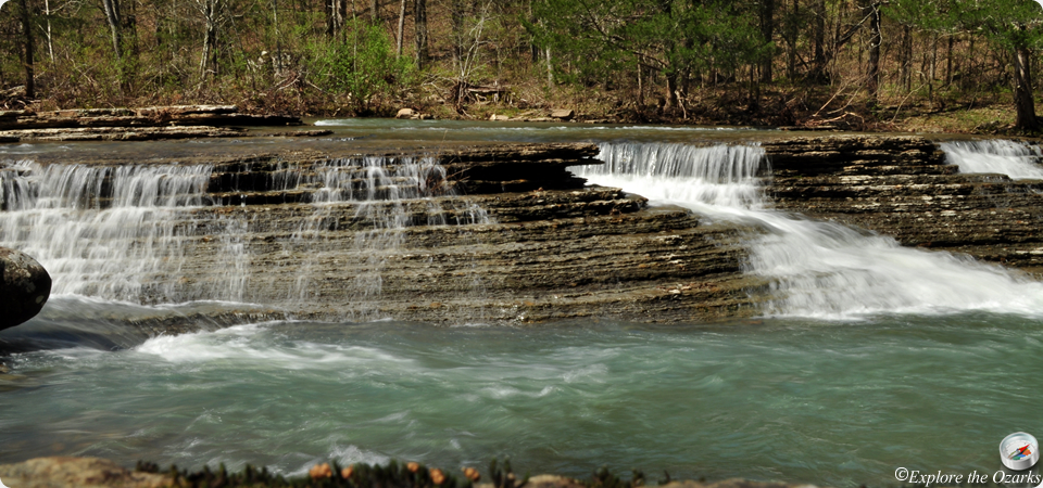
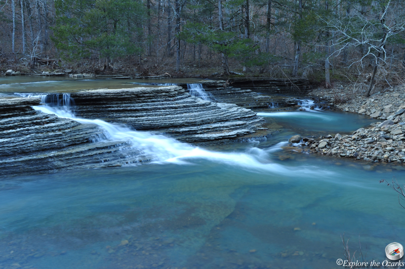
We are going to visit five waterfalls in this description: Horsetail Falls, Fuzzybutt Falls, Intersection Falls, Six Finger Falls, and Keefe Falls. All are accessed from FR# 1205/CR# 68.
Horsetail Falls: To get to first waterfall, Horsetail Falls, travel EAST on AR HWY 16 from Pelsor, which is located on Scenic HWY 7 between Russellville and Jasper. Travel about 9 miles on HWY 16 (past Pedestal Rocks/Kings Bluff) to the community of Ben Hur. About a mile east/south of Ben Hur, turn LEFT onto FR# 1205/CR# 68/Upper Falling Water Road. Follow this road for 5.3 miles, past Falling Water Falls, and PARK at a pulloff next to the bridge that crosses Falling Water Creek (N35 45.1524, W92 56.2890). You should see a horse trail on the west side of the bridge. Follow it downstream to the first creek crossing, then leave the trail to the LEFT and bushwack your way up the small stream until you reach Horsetail Falls. You can continue steeply up the left side of the falls, and you will find Upper Horsetail Falls.
Fuzzybutt Falls: The horse trail that leads by Horsetail Falls can also be used to access Fuzzybutt Falls, especially when Falling Water Creek is too high to wade across. Simply continue on the trail until you reach the mouth of a canyon on your left at 1.0. TURN LEFT and follow up the canyon a couple hundred feet to the falls.
Intersection Falls: Back at the bridge, continue to drive along the forest road another 0.4 miles, to the intersection with FR# 1219. Continue STRAIGHT ahead a few hundred yards, past the sharp curve in the road, then PARK on the LEFT side of the road. Bushwack down into the woods and to the left to Falling Water Creek, then hike upstream a few hundred yards to the base of the falls.
Six Finger Falls: Back on the road, continue on FR# 1205 for a couple hundred more yards, then PARK at a pulloff on your LEFT. Six Finger Falls will be just below you on Falling Water Creek. You can access Fuzzybutt from here, by wading the creek, then hiking downstream a few hundred yards to the mouth of the canyon, but sometimes it can be too dangerous to cross Falling Water Creek when the water is up.
Keefe Falls: From Six Finger Falls, drive down the road another ½ mile (0.6 from the intersection with FR#1219), to a spot where a small creek come in from the right and goes underneath the road. PARK here, wherever you can, and follow the little creek upstream as best you can. You will cross the Ozark Highlands Trail alomost immediately. You can either follow along the bottom to the base of the falls, keeping left when you come to a fork, or you can climb up to your left to the base of a tall bluff, and follow along the base of the bluff to the falls.