

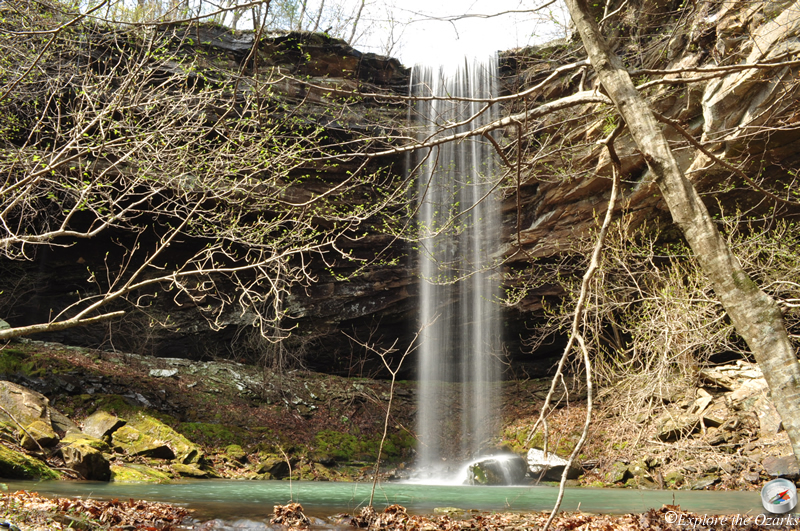


The Basics
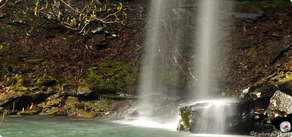
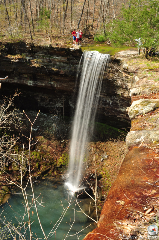
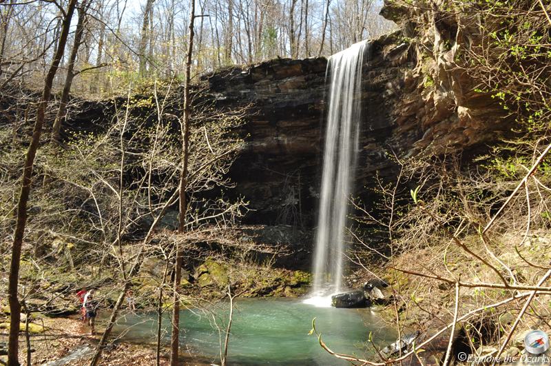
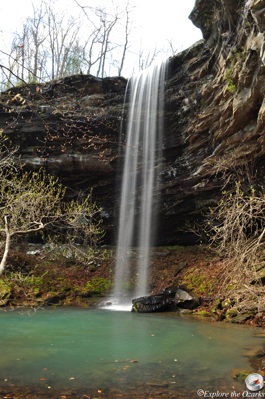
- Height: 56'
- GPS: N35 51.257, W93 26.075
- USGS Quad: Fallsville
- Distance: 2 miles One-Way
- Difficulty: Moderate Hike/Bushwack
- Location: Ozark National Forest
- Ranger District: Big Piney
- Sub-Location: Upper Buffalo Wilderness
- Region: Arkansas Ozarks & Boston Mountains
Details & Directions
This is a beautiful waterfall and a scenic area located in the Upper Buffalo Wilderness of the Ozark National Forest. The hike to it follows an old road, and is used by hikers, so it is usually easy to follow. The last part is a fairly steep bushwack down to the top of the falls, and a GPS is helpful.
To get to the trailhead, take AR Hwy 43 south from the town of Ponca, until you reach the intersection with AR Hwy 21. Turn Left and continue south through Boxley Valley for 1.2 miles, crossing over two bridges, and then Turn Right onto Cave Mtn Road (steep gravel road), which is just before the bridge that crosses the Buffalo River. Zero your odometer here. Travel up Cave Mountain Road, passing the Cave Mountain Church at 5.4, and the Hawksbill Crag trailhead at 6.0. Continue Straight for another 2.6 miles, until you come to FR# 1410 at 8.6, and Turn Left. Go 1.6 miles and Turn Left onto FR# 1410-B. If you are in a car or other low-clearance, Park here (add 1.0 mile to your hike). If you have a high clearance vehicle, preferably with 4wd, you can continue along the Jeep road to the trailhead. You pass a really BAD mud hole, especially with any amount of rain, and then come to a "T" intersection. Turn Left and park just a few yards ahead, where the road ends. (A right at the "t" will take you to Kapark cemetery)
Your journey begins by following the old road past the hump, with the road remaining mostly level, and coming to a small intersection at around 0.8. You may not notice the small path that leads off to the left, but we want to Stay Right and continue along the old road (Be sure to watch for this intersection on your way out, though). The road will begin to drop on down the hill some, and at 1.2 you will see a creek off to your left. This is the creek that feeds Bowers Hollow Falls, and it should be running well. You could follow this creek down to the top of the falls, but we will remain on the old road still.
The old road will remain fairly level, with a little up and down, and passes a couple of small creeks. At around 1.7 you will come to a creek on your left, with wild rose bushes near the trail. Also, you may see a rock cairn off to the left side of the road. This is where you will want to Turn Left and leave the old road, bushwacking alongside the small creek, and then you will arrive at the top of the falls at 2.0.
It is possible to get down to the base of the falls by crossing the creek above the fall (CAUTION it is very slick and a long drop to the bottom!) and following around the edge of the bluffline until you see a break in the bluff where you can climb down (Be Careful!). There is a beautiful pool at the base of the falls that makes the trip worth it!
While you are here, be sure to visit the other two waterfalls, which are just a little further down the old road, McClure Falls and Smith Falls.