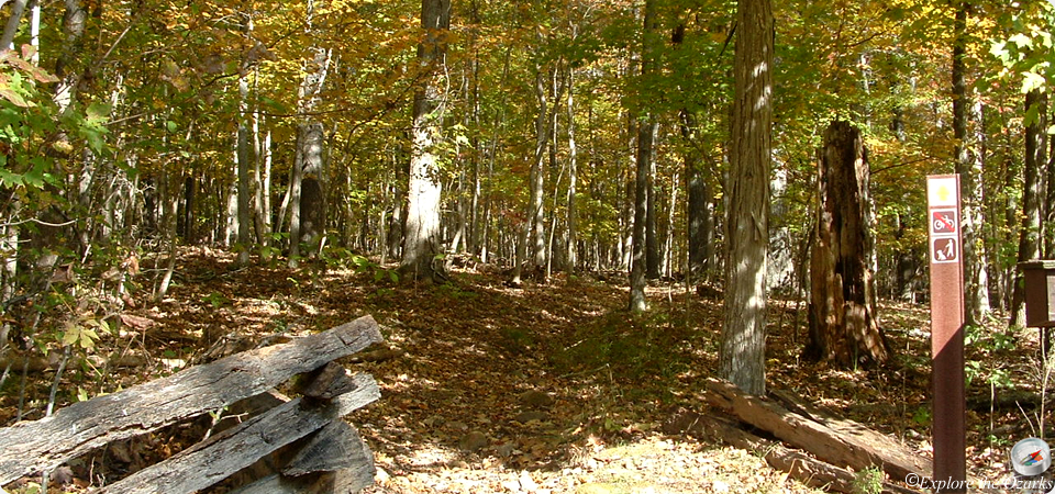

Hollow Pass Trail
- The Basics
- Type: Hiking, Equestrian
- Length: 0.6 miles One-Way
- Difficulty: Moderate
- Time: ½ hour
- Requirements: None
- Description
- The Hollow Pass Trail provides horseback riders, as well as hikers, a by-pass around Mudlick Hollow on the Mudlick Trail. The section of Mudlick Trail which passes through Mudlick Hollow is very rocky, steep, and includes narrow switchbacks that are very difficult for many horses to maneuver, so this part of the trail is recommended to be by-passed using the Hollow Pass Trail instead. Many hikers will hike out as far as through Mudlick Hollow, then use the Hollow Pass Trail as a return trail back to the starting point.
- Additional Info
- Camping: Backpacking allowed
- Water: No water on trail
- Trail Head(s): Located along Mudlick Trail
- Trail Markings:
- Pets Allowed:
- Recommended Season:
Mudlick Trail
- The Basics
- Type: Hiking, Backpacking, Equestrian
- Length: 12 miles Loop
- Difficulty: Moderate - Strenuous
- Time: 6 hours - Overnight
- Requirements: none
- Description
- The Mudlick Trail provides access into one of the oldest mountain regions in North America: the St. Francois Mountains. Ranging from 415 feet in elevation in the Big Creek valley, to 1,313 feet atop Mudlick Mountain, this 12 mile loop trail is moderate to very difficult in places. The trail is open to hikers and backpackers, and most of the trail is also open to equestrian riders. A majority of the trail passes through the 4,420 acre Mudlick Mountain Wild Area, one of the largest and most undisturbed natural wilderness landscapes in Missouri.
- Beginning near Big Creek, the first two miles ascend the bluffs of the creek valley, passing three stone hiking shelters constructed by the CCC in the 1930's. The shelters offer great views of the "shut-ins" and valley below. The trail then drops into Mudlick Hollow, a narrow, rocky, steep valley that can be very difficult for horses in places. The trail passes through the hollow for approx ¾ mile, passing by the northern backpack camp along Big Creek, then gradually ascends to the top of Green Mountain. Equestrian riders may by-pass the Mudlick Hollow section of the trail by using the Hollow Pass Trail. The trail follows along the ridge top of Green Mountain for approx 2 miles, and provides great views of the surrounding mountains, especially in late fall and winter, when the trees have shed their leaves. From the southern end of Green Mountain, the trail quickly descends to the valley below, following a series of switchbacks. At the bottom, near Logan Creek, the southern backpack camp is located. From Logan Creek valley, the trail then climbs to the top of Mudlick Mountain, passes along the eastern side of the mountain, then returns to the beginning.
- Additional Info
- Camping: Two designated backpack camps
- Water: Seasonally found in Mudlick and Logan Creeks; treatment recommended
- Trail Head(s): (1)Near Dining Lodge; (2)Equestrian Camp; (3)Equestrian Day-Use Area
- Trail Markings:
- Pets Allowed:
- Recommended Season:
Paved Bicycle Trail
- The Basics
- Type: Walking, Bicycling, Roller Skating, Skateboarding
- Length: 2 miles One-Way
- Difficulty: Easy
- Time: 1 hour
- Requirements: None
- Description
- This two mile paved trail runs from Campground #1 to near the Park Store, and is open to hikers, bicyclists, roller skaters, and skate boarders. Motorized vehicles (except motorized wheelchairs) and horses are not allowed on the trail. The terrain is fairly level along it's entire length, and access points are located throughout the park along the trail.
- Additional Info
- Camping: No
- Water: No water on trail
- Trail Head(s): Campground #1; Park Store
- Trail Markings: Paved
- Pets Allowed:
- Recommended Season:
Shut-Ins Trail
- The Basics
- Type: Hiking
- Length: 1½ miles One-Way
- Difficulty: Moderate
- Time: 1 hour - 1½ hours
- Requirements: None
- Description
- This trail begins on the Mudlick Trail, just up from the trailhead near the park store. Climbing up the hillside of Big Creek valley, visitors will find a small stone CCC built shelter, which offers beautiful views of Big Creek and its valley. The trail then descends back down into the valley below, and a quick detour is available to take hikers to the shut-ins along Big Creek. The trail continues traveling through the creek's floodplain, and hikers can find sycamores and cottonwood trees along the creek, as well as the unique yellowwood tree.
- Additional Info
- Camping: No
- Water: No water on trail
- Trail Head(s): Mudlick Trail, just NW of the Park Store
- Trail Markings:
- Pets Allowed:
- Recommended Season: