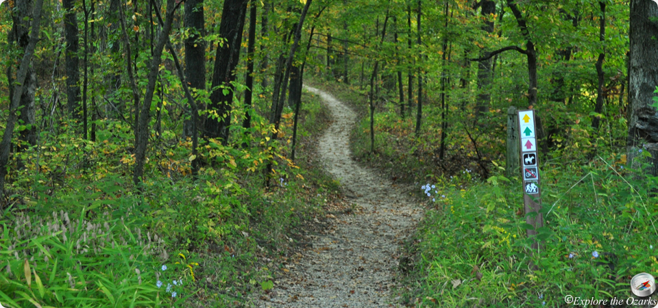

Lake Trail
- The Basics
- Type: Hiking
- Length: 2.25 miles Loop
- Difficulty: Easy
- Time: 1 - 2 hours
- Requirements: None
- Description
- Running along the shoreline of Lake Boutin, this easy looped trail will take hikers near the basic campground, across small ridges and valleys, and past old homesites. Rows of tulip poplars can be found that were planted by park staff in the 1960s. Also, the pennywort, a rare plant, can also been seen along this trail in early spring.
- Additional Info
- Camping: No
- Water: No water on trail
- Trail Head(s): Near Lake Boutin boat ramp
- Trail Markings: Green
- Recommended Season: Spring, Summer, Fall
Nature Trail
- The Basics
- Type: Hiking
- Length: ½ mile Loop
- Difficulty: Easy
- Time: ½ hour
- Requirements: None
- Description
- The shortest trail in the park, the Nature Trail begins near the visitor center, and follows up on the ridge. Many pawpaw and tulip poplar trees can be seen along the trail, as well as many spring wildflowers, including the penneywort. Visible wildlife includes whitetail deer, rabbits, squirrels, turtles, and more.
- Additional Info
- Camping: No
- Water: No water on trail
- Trail Head(s): Visitor Center
- Trail Markings: Black
- Recommended Season: Spring, Fall
Peewah Trail
- The Basics
- Type: Hiking, Backpacking, Equestrian
- Total Length: 10 miles Double Loop
- East Loop: 3 miles
- West Loop: 5.75 miles
- Difficulty: Moderate - Strenuous
- Time: 5 hours - Overnight
- Requirements: Check in with park staff if planning to backpack overnight
- Description
- This series of trails explores one of the most remote areas of the park, the Indian Creek Wild Area. It consists of two loops, with connectors trails to allow for shorter hikes.
- The east loop follows the ridge tops and bluffs along the Mississippi River, offering views of the valley below. A small spur trail also leads to an overlook of the river. The yellow trail of the east loop follows along the bluffs, then descends a valley with several creek crossings. This area is subject to flooding, depending upon the level of the Mississippi River, and portions of the trail may be underwater. It is a steep climb back out of the bottoms. A connector trail also leads to the west loop, or you can continue back to the trailhead.
- The west loop travels through several valleys and atop several ridges, too. The ridges offer dry, cherty soil with oaks and hickories, while the bottomland areas offer huge sycamores and sweet gums, plus numerous ferns can be found as well. Some backwater flooding can occur, depending upon the level of the Mississippi River, and portions of the trail may be underwater. A white connector along the west loop divides the loop, and provides access to a primitive backpack camping area. Please notify park staff if you plan to backpack overnight.
- Equestrian riders may park outside the overlook gate at the entrance to the west loop, and should avoid the trail during wet and muddy conditions. Please use caution while riding near the bluff areas. Equestrian camping is not allowed.
- Additional Info
- Camping: Backpacking site along west loop
- Water: No water on trail
- Trail Head(s): East and West loop trailheads located along Overlook Rd.
- Trail Markings: West Loop: Red East Loop: Yellow
- Recommended Season: Fall, Winter, Spring
Sheppard Point Trail
- The Basics
- Type: Hiking
- Length: 3 miles Loop
- Difficulty: Moderate - Strenuous
- Time: ½ - 3 hours
- Requirements: None
- Description
- Located in the southeast portion of the park, the Sheppard Point Trail heads to a towering bluff overlook along the Mississippi River, Sheppard Point. This overlook is a great place to view eagles in the winter. The trail also visits the Vancill Hollow Natural Area, which has a forest of trees more typical of the southern Appalachian Mountains than the Ozarks. Species include American beech, tulip poplar, and cucumber magnolia. The forest floor is rich with wildflowers and numerious types of ferns. The trail is steep in places, and offers rugged terrain.
- Additional Info
- Camping: No
- Water: No water on trail
- Trail Head(s): Visitor Center
- Trail Markings: Black
- Recommended Season: Spring, Fall