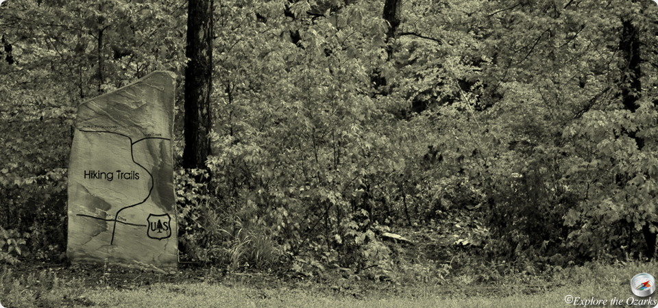
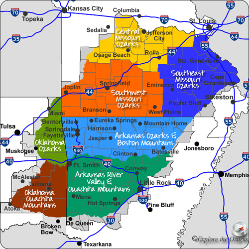

The rugged and scenic beauty of the Boston Mountains of the Arkansas Ozarks will keep you hiking these trails for many years to come, with memories that will never be forgotten. Beautiful scenery and hidden places can be accessed, such as the Twin Falls of Devil's Den State Park, scenic views of War Eagle Creek Valley, Alum Cove Natural Bridge, and all the wonderful trails found within the Buffalo National River.
The longest trail found within the Arkansas Ozarks is the 200+ mile long Ozark Highlands Trail, stretching from Lake Ft. Smith State Park in the west, passing thru the Ozark National Forest, then ending along the Buffalo River. Many scenic trails also connect to the OHT, including the Shores Lake-White Rock Loop, and the Redding-Spy Rock Loop.
**In an effort to keep the list of hiking trails manageable and more easily navagable, only those trails of 2 miles in length or longer are listed here. A few exceptions are those shorter trails having very specific, unique characteristics, or belonging to a network or system of trails totaling 2 miles in length or more. Many shorter trails are still available on state park and wildlife management lands, and are covered on their respective pages. I encourage you to hike these trails as well, and explore what they too have to offer.**
*Currently, there are so many more trails within the Ozarks and Ouachitas than I have had time to photograph, gather information for, and list here. As soon as new information becomes available, and I am able to either gather pictures or create a map, I will post those new trails here.*
| Trail | Length | Difficulty | Location | Region | Type |
|---|---|---|---|---|---|
| Alum Cove National Recreation Trail Go | 001.1 miles | Easy - Moderate | Ozark National Forest | Arkansas Ozarks & Boston Mountains | Hike |
| Butterfield Trail Go | 015 miles | Moderate - Strenuous | Devil's Den State Park | Arkansas Ozarks & Boston Mountains | Backpack, Hike |
| Devil's Den Self-Guided Trail Go | 001.5 miles | Moderate | Devil's Den State Park | Arkansas Ozarks & Boston Mountains | Hike |
| Glory Hole Trail Go | 001 mile | Easy | Ozark National Forest | Arkansas Ozarks & Boston Mountains | Hike |
| Gorley King Trail Go | 007 miles | Moderate | Devil's Den State Park | Arkansas Ozarks & Boston Mountains | Hike, Mtn Bike, Horse |
| Hidden Diversity Multi-Use Trail Go | 023 miles | Moderate - Strenuous | Hobbs State Park - Conservation Area | Arkansas Ozarks & Boston Mountains | Hike, Bike, Horse |
| Kings Bluff Loop Go | 001.7 miles | Easy | Ozark National Forest | Arkansas Ozarks & Boston Mountains | Hike |
| Old Road Trail Go | 005 miles | Moderate | Devil's Den State Park | Arkansas Ozarks & Boston Mountains | Hike, Mtn Bike, Horse |
| Pedestal Rocks Loop Go | 002.2 miles | Easy | Ozark National Forest | Arkansas Ozarks & Boston Mountains | Hike |
| Pigeon Roost Trail Go | 008.5 miles | Moderate | Hobbs State Park - Conservation Area | Arkansas Ozarks & Boston Mountains | Backpack, Hike |
| Sam's Throne Loop Go | 002.75 miles | Moderate | Ozark National Forest | Arkansas Ozarks & Boston Mountains | Hike |
| Vista Point Trail Go | 008 miles | Moderate - Strenuous | Devil's Den State Park | Arkansas Ozarks & Boston Mountains | Hike, Mtn Bike, Horse |
| War Eagle Trail Go | 002 miles | Moderate | Withrow Springs State Park | Arkansas Ozarks & Boston Mountains | Hike |
| Yellow Rock Trail Go | 003 miles | Moderate | Devil's Den State Park | Arkansas Ozarks & Boston Mountains | Hike |