


The Basics
Sam's Throne Recreation Area
AR Highway 123
Jasper, AR
Phone: (479) 284-3150 (Big Piney District Office)
Closest Towns: Jasper, Mt. Judea, Pelsor/Sand Gap
Directions: From Jasper, head East on AR Hwy 74 for approx. 9.7 miles to AR Hwy 123. Turn Right/South on Hwy 123/Hwy 74, and go approx. 4.5 miles, to the town of Mt. Judea. Where Hwy 123 and Hwy 74 split, turn Right/South onto Hwy 123. Follow this road for approx. 4.3 miles to the entrance on your Right.
About Sam's Throne
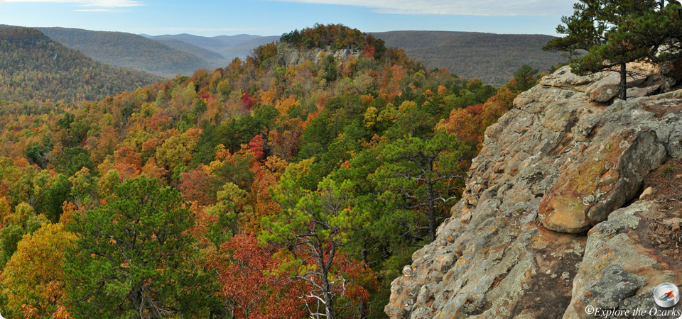
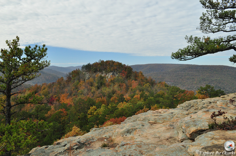
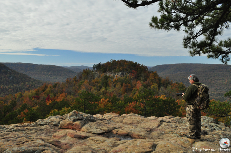
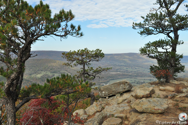
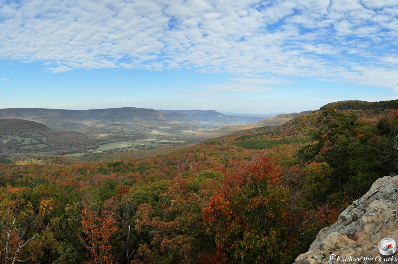
Primarily well known as a rock climbing site, Sam's Throne, near Mt. Judea, is also a popular hiking, camping and photography destination. Located up on Judea Mountain and overlooking the Big Creek valley below, the scenic views will show you why this is such a popular place.
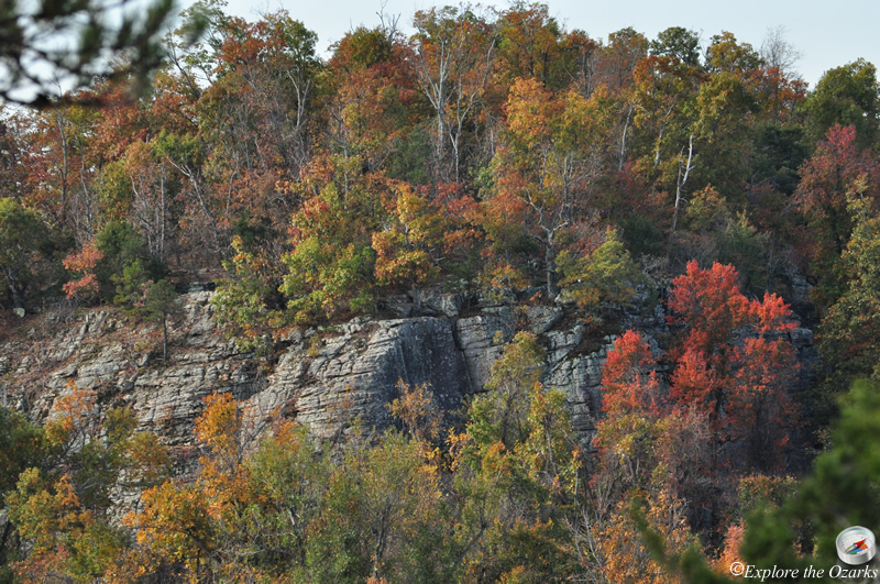
The area has been popular with rock climbers for many years, and numerous routes along the bluff offer challenges for everyone from beginning through experienced climbers. The climbs range from short bouldering up to 75' pitches. Top roping is popular here, and the Atoka sandstone has numerous solution pockets, knobs and crack systems. The Atoka sandstone caprock that forms the cliffs at Sam's Throne can be found within about a three mile radius of the area. The abundance of features here and surrounding areas are great for beginners. Most routes are in the 5.7 to 5.10 range, and are easily top roped.
Sam's Throne can get crowded, especially on weekends. Other nearby climbing areas include Cave Creek, Horseshoe Canyon Ranch, Rickett Mountain, Kent Mountain and Cherokee Crags.
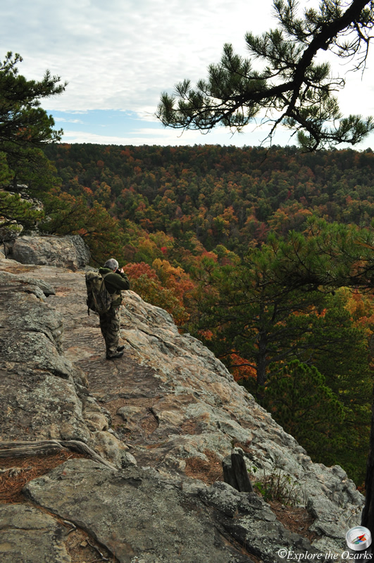
When you first pull into the recreation area, there is a parking area just to your right, before the road goes through a gate. This is the main parking area. You can also pull through the gate and follow the road a little ways to a turn around and small area with additional parking near the primitive camping areas. From here, there are three short trails that lead down to the bluff edge and viewing area, offering views of Sam's Throne and Big Creek valley below.
There is also a nice loop hiking trail that begins back up near the main parking area, and accesses below the bluff and on over to the base of Sam's Throne. From the main parking area, head through the gate and follow the road a few hundred yards to a small trail that leads off to your right. It passes by a small camping area, then turns right. It quickly comes to an area called the Dog Walk, which is a break in the bluffline that steeply leads down below. Once at the bottom, turn left and follow the bluffline, eventually coming below the viewing area where the bluff makes a point. From the trailhead to here, it is approx. 1 mile.
From this spot, the trail continues across a saddle ridge and on over to the base of Sam's Throne. The trail circles around the base of the mountain, passing by an access on the back side where you can scramble up to the top of Sam's Throne for even more impressive views.
Once back down on the trail, continue to follow it on around until you come back to where you first began. Follow the trail back towards the main bluffline. Just before you get back to the bluffline, you will notice a trail off to your right that follows an old road trace. You can either turn right here, or head back up to the bluffline and follow along the base of it to the right for a ways, exploring as you go. If you follow the old road, it will follow the main bluffline as well, just more off into the woods. After about a ½ mile or so, the old road will swing back to the right and start heading uphill. It will then swing back to the left and continue uphill, through a break in the bluffline. Once near the top, the old road will swing back to the right again, but we want to leave the road to the left, on a normal hiking trail again. This trail follows along the top of the bluff that you were just hiking below, and eventually works its way back to the viewing area and the camping area, with many scenic views along the way. The total loop is approx. 2.5 miles.
Although not a designated campground, there are about six primitive camping areas here, mostly popular with rock climbers. There is no electricity or running water here, but a vault toilet is provided. The road leading up AR Highway 123 from Mt. Judea is VERY steep and crooked, and CANNOT be negotiated by RVs or camping trailers.
What's Nearby
Parks & Nature
Alum Cove Natural Bridge Geologic Area
Pedestal Rocks Scenic Area
Richland Creek Wilderness
Trails
Alum Cove National Recreation Trail
Pedestal Rocks/Kings Bluff Loops
Camping
Fairview Campground
Haw Creek Falls Campground
Richland Creek Campground
Lodging
Local Eateries
Gear & Supplies
Other Attractions
Dogwood Falls
Falling Water Falls
Ft. Douglas/Hwy 123 Access
Hamilton Falls
Haw Creek Falls
Hudson Shelter Falls
Kings Bluff Falls
Pack Rat Falls
Pam's Grotto Falls
Richland Falls
Six Finger Falls
Twin Falls of Richland
Towns & Cities