


The Basics
St. Francois State Park
8920 U.S. Hwy 67 North
Bonne Terre, MO 63628
Phone: (573) 358-2173
Email: moparks@dnr.mo.gov
Directions: From St. Louis: Travel south on I-55 to the Festus/Hwy 67 exit. Travel south on Hwy 67 approx 22 miles, the park entrance is on the left. Large brown signs are visible on the hwy as you near the park.
About St. Francois
Once a refuge for Civil War outlaws and moonshiners, the Pike Run Hills and Big River of St. Francois State Park now serve as an escape from the daily grind of urban life. The park is a result of the efforts of the local residents of St. Francois County to preserve the natural and historical beauty of the area. The first acreage of the park was purchased in the 1960s, with the help of door-to-door fund raisers. After many grants, donors, and other donations, the park has expanded to its current 2,735 acres.
The park's history has truly affected the local cultural heritage. The earliest settlers came to work in the many lead mines that surrounded the park. The park area itself was explored for minerals, but no significant deposits were ever found.
During the Civil War, many local families were torn apart and divided against each other, causing for a colorful history. One such story involves a local guerilla fighter named Sam Hildebrand. Sam joined the confederacy to avenge the cold-blooded murders of his brothers by the Union militia. He was known to hide out in the park's blufftop caves, and eventually pinned down many Northern troops.
Decades later, moonshiners began using the cool, clear waters of Coonville Creek that run through Mooner's Hollow, hince its name. The spring-fed water was a key ingredient in making good quality moonshine. According to local custom, moonshine is called so because "it seemed to work out better if concocted in the night under the light of an Ozark moon."
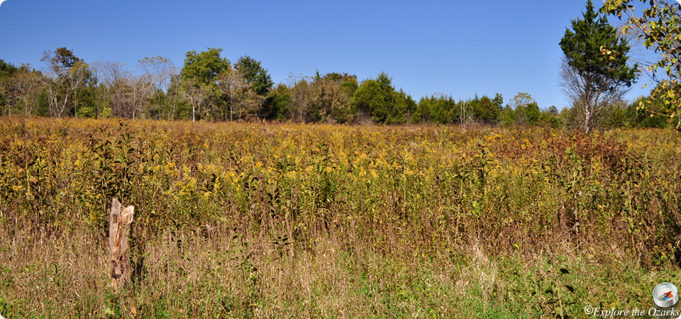
Marking the southern boundary of the park, the Big River and its slow-moving waters are great for fishing, swimming, or floating an Ozarks stream. The many glades and bluffs provide a scenic backdrop for these popular activities at the park.
Four trails will take visitors through the surrounding hills and valleys of the park, and two of those trails offer access to the Coonville Creek Natural Area. One of those trails, the Pike Run Trail, is also open to equestrians and overnight backpackers. This 11-mile trail travels mostly through the Coonville Creek valley and Natural Area, and is comprised of two loops, offering shorter hikes as well.
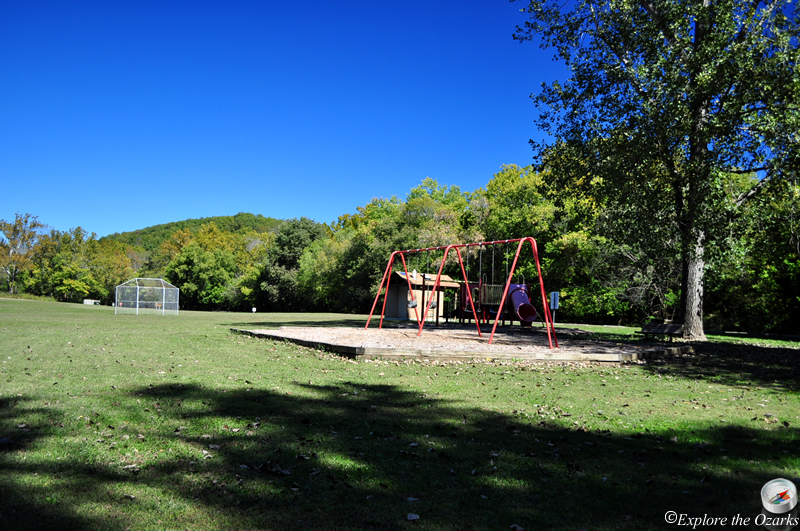
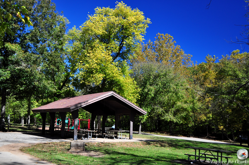
110 campsites with nearby modern restrooms, showers, laundry, and a dump station are available in the park's campground. More than 160 picnic sites are scattered throughout the park, and two picnic shelters can be reserved or used on a first-come, first-serve basis. Playground equipment, horseshoe pits, and ball fields are available as well.
Features & Facilities
Park Office | Pavilions | Picnic Area/Tables | Playground | Ballfield | Campground | Restrooms | Showers | Laundry | Dump Station
Activities Available
Camping | Hiking Trails | Equestrian Trail | Canoeing/Kayaking | Swimming | Fishing
What's Nearby
Parks & Nature
Bootleg Access
Elephant Rocks State Park
Hawn State Park
Pickle Springs Natural Area
St. Joe State Park
Washington State Park
Trails
Elephant Rocks State Park
Hawn State Park
St. Joe State Park
Washington State Park
Camping
Hawn State Park
St. Joe State Park
Washington State Park
Lodging
Local Eateries
Gear & Supplies
Other Attractions
Towns & Cities