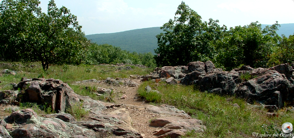

Mina Sauk Falls Trail
- The Basics
- Type: Hiking
- Length: 3 miles Loop
- Difficulty: Moderate
- Time: 1½ - 3 hours
- Requirements: None
- Description
- Beginning near the parking lot for the highpoint, the moderately rugged Mina Sauk Falls loop trail will take hikers to the state's tallest waterfall. The 132-foot tall waterfall is considered a wet-weather waterfall, only trickling water the rest of the year. The waterfall is around the halfway point, then the trail loops back to the start along a portion of the Ozark Trail. The best times to view the waterfall are after heavy rainfall, especially in the spring and early summer. If you can catch it flowing well in the fall, you are in for a real treat!
- Additional Info
- Camping: No
- Water: No water on trail
- Trail Head(s): Parking Lot
- Trail Markings:
- Pets Allowed:
- Recommended Season:
Ozark Trail - Taum Sauk Section
- The Basics
- Type: Hiking
- Length: 33 miles One-Way
- Difficulty: Moderate - Strenuous
- Time: Overnight - Mulit-Day
- Requirements: None
- Description
- The 33-mile Taum Sauk section is probably the most scenic AND most rugged section of the entire 300+ mile long Ozark Trail, which runs from near St. Louis, south and then west, close to the Arkansas border. The Taum Sauk section runs from Highway A in Reynolds County near the Bell Mountain Wilderness, thru Johnson's Shut-Ins State Park, up Taum Sauk Mountain, and over to Hwy 21 just east of Taum Sauk Mountain State Park. The Taum Sauk section is 33 miles long, and the stretch between Johnson's Shut-Ins and Taum Saum Mountain is about 13 miles long.
- Part of the trail within Taum Sauk Mountain State Park passes through the Devil's Tollgate. This eight foot wide passage is roughly 50 foot long, and passes through volcanic rhyolite nearly 30 feet tall. It is truly something to see. Of course, don't forget to take the side trip to Mina Sauk Falls if you are just passing through the park while hiking the Ozark Trail. Even if the falls are running low, the scenery is still well worth the trip.
- Additional Info
- Camping: Allowed at least 100' from the trail,
outside of either state park's boundaries - Water: No water on trail
- Trail Head(s): Hwy A; Johnson's Shut-Ins SP;
Taum Saum Mtn SP; Hwy 21 - Trail Markings: Green & White OT signs
- Pets Allowed: Yes, must be leashed
- Recommended Season: All Year