


The Basics
Taum Sauk Mountain State Park
c/o Johnson's Shut-Ins State Park
Southwest of Ironton, MO
Phone: (573) 546-2450
Email: moparks@dnr.mo.gov
Directions: From Ironton: Head south on Hwy 21 approx five miles to Route CC. Turn right onto Route CC, the park is in about four miles.
About Taum Sauk Mountain
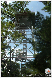
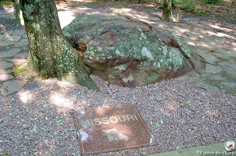
Escape to a vast wilderness atop Missouri's highest peak, 1,772-foot Taum Sauk Mountain. The surrounding wilderness and solitude are definately worth the trip. An easy walk from the parking lot provides access to this high point, and a lookout tower gives great views of the surrounding St. Francois Mountains, still looking much the same as when the first settlers arrived.
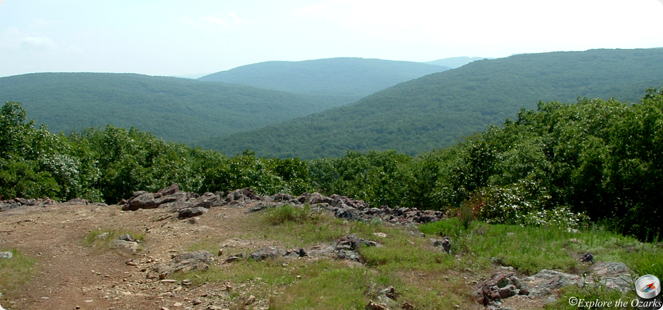
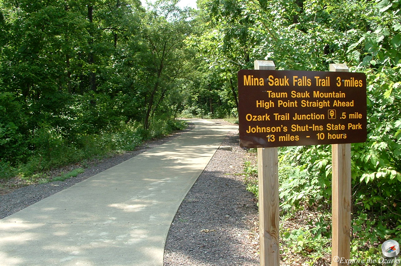
While you're here, be sure to visit Mina Sauk Falls, the state's tallest (wet-weather) waterfall. The three mile Mina Sauk Falls loop trail is a moderately rugged trail that will take you to the falls, plus spectacular views of the state's deepest valley to the west, which has up to 700 feet of vertical difference between the creek bottom and the surrounding mountain tops. The trail is great hiking anytime of the year.
Running through the park, and connecting it with Johnson's Shut-Ins State Park, is the Taum Sauk section of the Ozark Trail. The portion of this trail that joins the two parks is over twelve miles in length, and travels through some remote country. About one mile below the falls along the Taum Sauk section lies the Devil's Tollgate. This eight foot wide passage is roughly 50 foot long, and passes through volcanic rhyolite nearly 30 feet tall. It is truly something to see. The 33-mile Taum Sauk section is part of the 300+ mile long Ozark Trail, which will eventually run from St. Louis all the way down to Arkansas.
The state park is part of the larger St. Francois Mountain Natural Area, known for its outstanding natural and geologic features. The 7,028-acre natural is the largest natural area in the state, and offers an insight of what the area looked like before human influence and settlement.
The park offers a small campground, with 12 basic campsites. Nearby, a picnic area is perfect for a quick lunch after visiting the park for just a few hours. Drinking water and a pit toilet are available at the parking lot. A special-use camping area is also available for non-profit organized youth groups.
Features & Facilities
Observation Tower | Picnic Area/Tables | Campground | Pit Toilet | Waterfall
Activities Available
What's Nearby
Parks & Nature
Bootleg Access
Elephant Rocks State Park
Johnson's Shut-Ins State Park
Ketcherside Mountain Conservation Area
Mark Twain National Forest
Millstream Gardens Conservation Area
St. Joe State Park
Trails
Elephant Rocks State Park
Johnson's Shut-Ins State Park
Mark Twain National Forest
St. Joe State Park
Camping
Johnson's Shut-Ins State Park
Mark Twain National Forest
St. Joe State Park
Lodging
Johnson's Shut-Ins State Park
Local Eateries
Gear & Supplies
Other Attractions
Towns & Cities