
Brushy Creek Nature Trail
- The Basics
- Type: Hiking
- Length: ¾ mile
- Difficulty: Easy
- Time: ½ hour - 1 hour
- Requirements: None
- Description
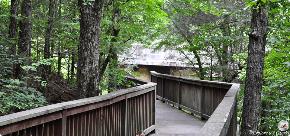
- Beginning in the parking lot of the Brushy Creek Recreation Area, this trail follows a ridge top that offers an overlook of Brushy Creek where it meets the Cossatot River. Along the trail is a guided tree trail, offering visitors information about the different species of trees in southwest Arkansas. Also available on this trail is a steel walkway that spans across the river, offering access from the west side parking lot. This walkway also allows visitors to cross from the west side of the river to the east side. This is where the picnic grounds and a swimming area are located.
- Additional Info
- Camping: No
- Water: Cossatot River
- Trail Head(s): Brushy Creek Rec Area (Hwy 246)
- Trail Markings:
- Pets Allowed:
- Recommended Season:
Harris Creek Trail
- The Basics
- Type: Hiking
- Length: 3½ miles
- Difficulty: Easy - Moderate
- Time: 2-3 hours
- Requirements: None
- Description
- Starting at the Hwy 278 Access area, the Harris Creek Trail winds it way through six different habitat ranges. Around the half way point, there is an overlook that offers a breathtaking view of the Cossatot River and surrounding Ouachita Mtns.
- Additional Info
- Camping: No
- Water: No water on trail
- Trail Head(s): Hwy 278 Access Area
- Trail Markings:
- Pets Allowed:
- Recommended Season:
River Corridor Trail
- The Basics
- Type: Hiking/Backpacking
- Length: 14 miles
- Difficulty: Moderate - Strenuous
- Time: 6 hours- overnight
- Requirements: None
- Description
- The River Corridor Trail winds its way through some of the most scenic, and rugged, terrain found in the Ouachitas. The trail is divides into sections between river access areas. Plan for approx six-eight hours per section. Although this trail is great for backpacking, park officials ask that hikers limit their camping to the access areas. These are: Ed Banks, Sandbar, Cossatot Falls, and Hwy 278 Access area. Parking is also available at each of the areas, so the trail may be broken into smaller hikes. Many wonderous geological features and views of the river are available along this trail. The trail terminates at the Hwy 278 Access Area.
- Additional Info
- Camping: Restricted to river access areas (Ed Banks, Sandbar, Cossatot Falls, Hwy 278 Access)
- Water: Cossatot River
- Trail Head(s):
- Trail Markings:
- Pets Allowed:
- Recommended Season: