
Copyright, Disclaimer, Privacy Policy
and Other Important Information
1.) Copyright
All text, images, graphics, photographs, maps, GPS track or coordinates (waypoint), and other materials on this website are subject to the copyright and other intellectual property rights of Explore the Ozarks, LLC. Such materials are the property of Explore the Ozarks, LLC, or are in use by Explore the Ozarks, LLC with permission of the owner(s), or are in the public domain.
You may not copy, print, redistribute or reproduce all or part of any of the contents of this website without prior permission, other than the following:
- You may print or download to a local hard disk or GPS device any map, GPS coordinate (waypoint) or GPS tracklog, so long as it is strictly for personal and non-commercial use only. Any other use or distribution is strictly prohibited.
Any reproduction, redistribution, modification or commercial explotation of all or part of the contents of this website, without prior written consent, is strictly prohibited, including transmission or storage in any other website or other form of electronic information retrieval and storage system.
2.) Disclaimer
While every effort possible has been made to ensure the accuracy and reliability of the information contained within this website, many sources of information and other factors, whether natural or man-made, can change drastically from time to time. These can include, but are not limited to, road names and conditions, trail names and conditions, river levels and conditions, public and private land access and ownership, campground changes and closures, and/or any other unforseeable electronic, mechanical, technical, human or natural issues beyond our control. See section 4: Other Important Information below for more information on these and other certain specific issues.
The information, maps and photographs contained within this website are provided by Explore the Ozarks, LLC, and while we strive to keep the information as up-to date and accurate as possible, we make no representations or warranties of any kind, express or implied, about the completeness, accuracy, reliability, suitability or availablilty with respect to the website or the information, maps, photographs, products, services or related graphics contained on the website for any purpose. Any reliance you place on such information is therefore strictly at your own risk.
In no event will Explore the Ozarks, LLC be liable for any loss or damage including without limitation, indirect or consequestial loss or damage, or any loss or damage whatsoever arising from loss of data or profits arising out of, or in connection with, the use of this website.
Through this website you are able to link to other websites which are not under the control of Explore the Ozarks, LLC. We have no control over the nature, content and availability of those sites. The inclusion of any links does not necessarily imply a recommendation or endorse the views expressed within them.
Every effort is made to keep the website up and running smoothly. However, Explore the Ozarks, LLC takes no responsibility for, and will not be liable for, the website being temporarily unavailable due to technical issues beyond our control.
3.) Privacy Policy
This privacy policy sets out how Explore the Ozarks uses and protects any information that you may give Explore the Ozarks when you use this website.
Explore the Ozarks is committed to ensuring that your privacy is protected. Should we ask you to provide certain information by which you can be identified when using this website, then you can be assured that it will only be used in accordance with this privacy statement.
Explore the Ozarks may change this policy from time to time by updating this page. You should check this page from time to time to ensure that you are happy with any changes. This policy is effective from: 1 Nov 2011.
WHAT WE COLLECT
We may collect the following information:
- name & gender
- contact information including email address
- demographic information such as zip code, preferences and interests
- other information relevant to customer surveys and/or offers
WHAT WE DO WITH THE INFORMATION WE COLLECT
We may require this information to understand your needs and provide you with better service and information, and in particular for the following reasons:
- internal record keeping
- we may use the information to improve the website and its contents
- we may periodically send promotional emails about new products, special offers or other information which we think you may find interesting using the email address which you have provided.
LINKS TO OTHER WEBSITES
Our website may contain links to other website of interest. However, once you have used these links to leave our site, you should note that we do not have any control over that other website. Therefore, we cannot be responsible for the protection and privacy of any information which you provide while visiting such sites, and such sites are not governed by this privacy statement. You should exercise caution and look at the privacy statemant applicable to the website in question.
CONTROLLING YOUR PERSONAL INFORMATION
We will not sell, distribute or lease your personal information to third parties unless we have your permission or are required by law to do so. We may use your personal information to send you promotional information about third parties which we think you may find interesting.
SERVER LOG FILES
We use IP addresses to analyze trends, administer the site, track users movement within the website, and gather demographic information for aggregate use. IP addresses are only linked to personally identifiable information if you order products on this website or post data on the forums.
4.) Other Important Information
- 4a. Camping
- General Info
- Wildlife
- Backpacking
- Low Impact Use
- Fires
- 4b. Trails
- General Info
- Trail Types
- Trail Etiquette
- Wildlife & Bugs
- Maps & Mileages
- Water
- Fires
- Low Impact Use
- 4c. Rivers & Floating
- Disclaimer
- Difficulty Ratings
- Distances & Mileages
- River Hydrology
- Safety
- Legal Rights of Paddlers
- 4d. Swimming Holes
- Jumping/Diving
- Water Conditions
- Hypothermia
- 4e. Waterfalls
- Maps
- Distances & Difficulty Ratings
- Parking Areas
- 4f. Springs
- 4g. Caves
- 4h. Bluffs & Rock Climbing Areas
- 4i. Wilderness, Natural, Scenic & Wildlife Management Areas
- Wilderness Areas
- Natural Areas
- Scenic Areas
- Wildlife Management Areas
- 4j. Plants & Wildlife
- 4k. Area Conditions
- 4l. Parking
- 4m. Roads
- 4n. GPS
- 4o. Maps
- 4p. Weather & Seasons
4a. CAMPING
I. General Info
While many campgrounds listed on this website can be found in secluded, remote areas with no one else around for miles, the majority of camp sites are found within the numerous State Park Campgrounds, Army Corps of Engineers Campgrounds, National Forest Campgrounds, or on private campgrounds. The majority of these campgrounds can get very crowded during the on-season (typically spring & summer), especially on the weekends, and even more so on holiday weekends. Reservations are highly recommended. Some campgrounds are also closed during the off-season (typically winter), so you should check with the local governing agency prior to arrival, to make sure the campground is open.
Please keep in mind that most campgrounds also have quiet hours, usually from at least 10:00 pm to 6:00 am. Other campers may want sleep for their big day of exploring, or may have children who go to bed early. Please be respectful of your neighbors.
The vast majority of campgrounds offer fully modern facilities, including electric, water & sewer hookups for RVs and Campers, plus modern restrooms with flush toilets and hot showers. Others campgrounds may only offer primitive sites, with no electricity or running water, and may only have a pit toilet and no other facilities. Prices for most campgrounds will vary according to the type of site and the availability of these facilities.
Be sure to keep a clean camp site, and PLEASE DO NOT LITTER!
II. Wildlife
Remember that most campgrounds are located in or near the wilderness, which is home to many wild animals, including skunks, squirrels, birds, raccoons, foxes, deer and bears. These are WILD animals, and will always be looking for a handout, so don't leave food lying around for them to steal. Make sure to keep your food and garbage stored tightly away in a vehicle or hanging up high, out of reach or climbing distance. Otherwise, you could find a big mess and no breakfast the next morning.
Bears are found throughout the Ozarks and Ouachitas. Thay are almost always never a problem, so lets try and keep it that way. Please, keep all food and garbage in a secure place, such as in a vehicle or hung up high from a branch in a tree, out of reach or climbing distance. DO NOT FEED THE BEARS OR OTHER WILDLIFE! Wildlife, especially bears, have a hard time distinguishing between handouts and natural foods that are available. If you feed a bear, it will associate humans with food, and will become increasingly persistant at trying to get food from other humans, or yourself, in the future. Learn more about camping with bears
III. Backpacking
Backpacking sites, typically those found within the remote backcountry, usually have no traditional designated site, and have no facilities whatsoever, offering a true wilderness experience. Camping is also usually allowed anywhere within the National Forests, so long as at least these rules and guidelines are followed:
- Camp at least 100yds away from any trail, water source or scenic area, and at least ¼ mile from any trailhead or parking/access area
- Keep groups small; 10 or less is best
- Always pack in what you pack out
- Please leave your camp site so that others won't be able to tell you've been there
- Build fires only if necessary; DO NOT build a new rock/fire ring if one is not already available
- Bury all human waste at least 100' from any trail or water source. Dig a hole 6-8 inches deep, fill it, then cover the hole with a layer of topsoil
IV. Low Impact Use
1. Camp in established sites
Overnight campers probably have one of the biggest impacts on the land while visiting the backcountry. If everyone camped in a different location each night, then there would be much more widepsread damage than if they used the same sites each time. If you must choose a new site, choose one at least 100yds away from any trail, water source or scenic area, and preferably out of sight. Please DO NOT build a new rock/fire ring. The blackened rocks will remain an ugly sight for a long time, and take away from the scenic beauty of the area.
2. Protect the water
Clean water is not only important to nature, wildlife and the environment, it is also essential to our own quality of life. A good rule of thumb to use while out in the wilderness, or anywhere else for that matter, is simply this: Don't put anything into the water. Whatever you may put into the water, whether it may seem harmless or not, always winds up downstream. And we all live downstream, so keep that in mind while you are out in the wilderness.
3. Bury all human waste...
... and keep your bathroom duties out of sight. It's as simple as that, and should seem obvious to most of us, but there are still many ignorant people who just don't seem to understand this. You need to be completely out of sight AND at least 100' from any trail, campground, water source, scenic area or parking/access area.
Dig a small hole 6-8 inches deep, fill it in, then cover the hole with a generous layer of top soil when you're done; nature will take care of the rest. No one wants to hike down a trail, float down a stream, or arrive at a campsite only to find somenoe else's "business" right there, yet why do people still do this?
4. Cook with a stove
Although building a campfire to cook with may be "tradition" they are not absolutely necessary. Cooking with a lightweight camping or backpacking stove is much quicker, easier, and a whole lot cleaner. If you must build a fire, keep it small, DON'T build a new rock/fire ring, and only use dead branches that can easily be gathered on the ground and broken with your hands. See the next section, Fires, for more info.
5. Leave No Trace
The idea of the Leave No Trace practice of ethical outdoor use comes from these seven principles:
- Plan ahead and prepare
- Travel and camp on durable surfaces
- Dispose of waste properly
- Leave what you find
- Minimize campfire impacts
- Respect wildlife
- Be considerate of other visitors
V. Fires
As discussed earlier, campfires are not absolutely necessary to enjoy your wilderness experience. Cooking with a lightweight camping or backpacking stove is much quicker, easier and a whole lot cleaner. If you must build a campfire, keep it small, use only small dead branches that can easily be broken with your hands, and only use existing rock/fire rings. Please, DO NOT build a new rock/fire ring if one is not already available. The blackened rocks will remain an ugly scar for a long time.
To build a low-impact campfire, you must first clear away all flamable debris, including leaves, sticks, and other debris, all the way down to the bare dirt. Build a small fire in the middle of the cleared out area, usually starting with dead leaves and very small sticks. Add more leaves, then larger sticks and branches until they will burn on their own. Use only dead sticks and branches that can easily be gathered from the ground. If you cannot break it with your hands, then it is probably too big. Also, if you have to use a saw, it is also probably too big. Large wood seldom ever completely burns up all the way, and what is left is an ugly black chuck of wood. DO NOT CUT OR DESTROY LIVE VEGETATION OR TREES!
Top Menu
4b. TRAILS
I. General Info
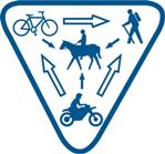
The Ozarks and Ouachitas offer some of the best & most diverse trails in the country. Everything from short, paved, handicap accessible trails to lengthy, multi-use trails for hikers, mtn bikers, backpackers, horseback riders, and offroad/ATV users can be found. Below, you will find some information that may be helpful before you venture out into the wilderness.
II. Trail Types
Just about every type of trail can be found & explored in the Ozarks & Ouachitas.
1. Hiking & Backpacking
Hiking and Backpacking remain the most popular use of trails, and almost every trail can be hiked, even many of those designated for mountain bike, equestrian or ATV use. Almost every trail offers great dayhiking opportunities, and many are long enough for backpacking as well. Generally speaking, most trails located within the National Forests and the Buffalo National River allow camping along the trail. Most state park, conservation/wildlife area, and Army Corps of Engineers (lakes) trails are not open to backpacking, but there are a few exceptions.
Most backpacking trails do not require a permit to camp, but some do. If you are uncertain, be sure to check with the local governing agency before attempting to camp. Also, some state parks may also require an entrance/parking fee, so be sure to check with the office for current information about fees & permits.
Be sure to practice Low Impact Use while out on the trails, and we will have these trails around for many generations to come!
2. Mountain Biking
The Ozarks and Ouachitas are blessed with many miles of trails open to mountain bikers, including numerous miles of former railroad lines converted to hiking and mountain biking use. And while mountain biking may be gaining in popularity with many outdoor enthusiasts, it is also becoming an unpopular activity with some local governing agencies, mainly due to the actions of a few irresponsible trail users. To help keep a positive outlook on the sport, and to help maintain access to trails in the future, certain rules and regulations are recommended. A good list to follow while out on the trail is recommended by the International Mountain Bike Association.
3. Equestrian
Traveling down a trail from the saddle of a horse is a truly rewarding experience while out exploring the Ozarks. Numerous trails are open to equestrian riders, and many are also shared with other trail users, such as hikers and mountain bikers. Because of this, care and respect to these other users as well as the trail & surrounding environment must be practiced, to ensure the trails will be open to horses for future generations. A few simple guidelines to follow include:
- Before hitting the trail, se sure you and your horse are comfortable with basic riding skills, such as stopping and turning, and having control at all times and at all gaits.
- Make sure you and your horse are in good enough physical condition for the length and duration of the trail.
- Keep tack in good condition to prevent anything from breaking while out on the trail.
- Remember to check the weather before you ride, and dress accordingly.
- Plan your route and stay on equestrian approved trails only.
- Be sure to let someone know where you are going and when you plan to be back.
- Don't hit the trail without a little warm-up for you and your horse first.
- Be sure to rest and walk after periods of trotting.
- Be friendly to others you encounter out on the trail.
- Always be aware of your surroundings and plan ahead, so that you don't put yourself or your horse in a dangerous situation.
- Try to know the depth of a water crossing before attempting it, and be sure to offer the horse some water to drink.
4. Offroad/ATV
ATV, dirtbike and other utility/off-road vehicle use has increased dramatically in the past few decades. More and more powersport enthusiasts are hitting the trails, but in some areas, this is having a poor impact on the area, and is causing a negative spotlight on the sport. Extreme care and ethical & moral use while out on the trails MUST be practiced, or we risk losing this great opportunity to explore the Ozarks and Ouachitas, and possibly even having these trails closed.
We must all do our part to protect the wilderness and the activities we enjoy. Below are just a few simple guidelines to follow while out on the trail:
- Pack it in, pack it out; Please, DO NOT LITTER!
- Do not block, restrict or interfere with the use of roads or trails.
- Obey area & trail restrictions concerning their use, especially when it comes to off-road vehicle use.
- You may be required to pay a fee to use certain developed off-road use areas, sites or facilities. Such fees help to maintain the area and the trails, and are a necessary part of the sport. These areas are usually marked with signs.
- Each off-road vehicle must be equipped with a muffler in good, working condition, and must also be equipped with an approved spark arrester.
- When two or more off-road vehicles are operating together on a road or trail, they should be operated in a single file fashion.
- NEVER operate an off-road vehicle under the influence of alcohol or drugs.
- DO NOT operate an off-road vehicle if you are under the state's or manufacturer's legal or recommended operating age.
- DO NOT carry passengers on off-road vehicles that were not designed from the manufacturer to do so.
- DO NOT ride through streams or other natural water sources; only cross streams where the trail is designed to do so.
III. Trail Etiquette
With trail use increasing each year, and so many trails open to multi-use activities, how we act while out on the trail and how we interact with others can have a lasting impression upon our preferred trail use, whether it be hiking, backpacking, mountain biking, equestrian riding or offroad use. Listed below is a good set of recommendations and commonly accepted practices to make your experience, and that of others, more enjoyable while out on the trail.
- Stay on the trail; DO NOT cut switchbacks or take shortcuts while out on the trail. These actions can lead to erosion and trail degredation.
- Stay to the right on wide enough trails, and pass on the left.
- When passing someone, let them know you are approaching and will be passing on their left, especially when passing an equestrian rider, so you don't spook the horse. If you hear someone call out "on your left" as they approach from behind, you should stay to your right and let them pass.
- Whenever you stop for a view, to rest, or to yield, step off the trail so that it is free for others. Be sure to try and step off the trail on a used area or a durable surface, such as a rock, dirt or snow. Don't go trampling through a field of grass or wildflowers.
- Trail users going uphill are working much harder than those going downhill, and it is harder to regain your momentum after stopping while traveling uphill vs. downhill. Uphill users should be given the right of way. Sometimes, uphill users will prefer to stop and let you pass so that they can take a short break. The uphill user should get to make the call.
- When hiking in a group, hike in a single file line or take up no more than half of the trail's width. Make sure everyone in the group understands what they should do when encountering other hikers, bikers or horses.
- When meeting an equestrian rider, move off the trail on the downhill sire. Horses will naturally bolt uphill if spooked. Also, someone waiting on the uphill side may look more like a predator waiting to pounce.
- Quietly greet the rider and ask if you are ok where you are.
- Stand quietly and still while the horse passes.
- Read trailhead guidelines. There may specific rules for the trail you are on.
- Pack it in, Pack it out. DO NOT LITTER!
- Take nothing but pictures, leave nothing but footprints. You may have heard this a thousand times, but the message remains strong and true. Do not take anything with you that you did not already bring, and do not leave anything extra behind. In fact, in most places, it is illegal to remove ANY rocks, plants or historic artifacts. Leave it where you found it for others to enjoy.
- Report vandalism. Be sure to contact the local governing agency about any destruction you mave have noticed or witnessed, or about any other issues or trail conditions that may need attention.
IV. Wildlife & Bugs
The Ozarks & Ouachitas are blessed with an abundance of wildlife, both small and large. Trail users have the chance to see everything from bald eagles to hummingbirds, lizards to snakes, even deer, elk and bears. Most wildlife will flee at the sight or sound of a human, but if you take the time to stop and wait and listen, that is when you have the best chance of seeing something.
Yes, there are bears in the Ozarks & Ouachitas. In fact, about a century ago, Arkansas was known as the Bear State, due to its large bear population. The Missouri Ozarks has also seen an increase in bear numbers in recent years. The bears that populate this area are black bears, most of them not too much bigger than you or I. And while incidents involving bears are almost non-existent, that doesn't mean you should ignore them or be unprepared. They can be dangerous and unpredictable under the wrong circumstances. Most bears will take off as fast as they can at the sight, sound or smell of a human. Loud noises usually will send away a curious bear.
Bears do have an amazing sense of smell, and can smell food from miles away. If you backpack or camp while out on the trails, be neat and keep a clean camp. Be sure to cook and keep all extra food and cooking utensils a good distance away from where you sleep. DO NOT KEEP FOOD IN YOUR TENT!
The Ozarks & Ouachitas also have their fair share of snakes. While there are numerous different species, and most are harmless, the ones you should watch out for are mainly rattlesnakes, copperheads and cottonmouths. Yes, they do bite, but snake bites are rare, and are usually the result of someone playing with one. A snake will not seek you out and bite you, but instead will usually flee. But, if you reach out and pick one up, or step on one, they will bite. Watch your step, DO NOT play with snakes, and you should be just fine.
There are probably more types of bugs in the Ozarks than you would care to count. Towards the end of spring and into the summer months, mosquitoes and ticks will start showing up. Soon after, as the summer heats up, the chiggers will come out, too. And just about the time it gets nice and hot and dry, and they start disapperaing, then the gnats and horseflies come out, and they will really bug you!
There is no 100% guaranteed way to keep them all from bothering you. A good, strong insect repellant with DEET will help alot. Also, don't smell good. Take a shower, of course, but don't use any sweet smelling scents, the bugs seem to be really attracted to them. Campfire smoke helps to keep 'em at bay.
Towards late summer and into early fall, the spider webs can get really thick across the trails. A headnet can be helpful this time of year.
By mid-to-late fall, most of the bugs should be gone until next spring. But, during a real mild winter, you may still find ticks out on a warm day. If you find one on you, just reach dwon and pull it off, it's not a big deal at all. However, with Lyme Disease becoming more common, if you do suspect a problem, be sure to tell your doctor, and let them know that you have been out in the woods, and that ticks should be considered as a possible cause.
V. Maps & Mileages
The trail maps provided on this site are intended to display the route of each trail as accurately as possible. Each map was carefully researched and constructed using several reliable sources of information, including current and historic maps and books, as well as first hand knowledge of each trail. However, maps are designed to be a representation of an area, not an exact duplication. I feel that the information provided on these maps is as accurate as possible, but, errors can and do occur from time to time. If you happen to notice any errors or mistakes, please let me know immediately, so that the correct information can be verified and posted as soon as possible.
GPS coordinates have been provided on most maps for trailheads, parking/access areas, and/or other important features found along the trail. These coordinates can simply be input into your handheld or vehicles GPS unit for directions to that coordinate.
Driving directions are usually given from the town/city that is closest to the main trailhead(s) or access point(s). Other local or highway maps may be needed to get you to the closest town/city from wherever you may be.
1. Distances
The distances for most trails will be listed in miles, except for some trails that are less than a mile in length. Mileages are given for one-way distances, unless otherwise noted, such as a loop trail. The distances have been calculated using a variety of different methods, including using a measuring wheel rolled along the trail, GPS distance readings, park/trail brochures or maps, careful plotting of the trail's path on the computer over topo maps, and other reliable sources such as books and maps.
Several of the longer trails may have mileage posts marked every mile or so; I try to use these mileages in the trail's descriptions, even if they may be wrong, to avoid confusion.
2. Difficulty Ratings
The difficulty ratings listed on this site are intended as a general guide to help you plan a trip along the trails. Many factors can change, affecting the actual difficulty level. Some of the more constant factors used to determine the difficulty level for each trail include length, terrain, average trail conditions, elevation change, etc...
- Easy - Shorter distances over mostly level terrain following an established trail or road. Suitable for most everyone, including older children.
- Moderate - Longer distances, usually from 2-3 miles to around 6-8 miles in length, over varying terrain with slight elevation changes on well worn trails and/or mostly cleared roads. Those with some hiking experience or that are in fairly good physical condition should have no problems. May be tougher for weaker hikers or for children.
- Strenuous - Even longer distances of around 7-8 miles or longer in length, still following worn trails or roads, but with rougher terrain and/or greater elevation changes. These trails are mainly for experienced hikers and/or those in good physical condition. NOT good for kids.
VI. Water
During the "wet" season, typically spring through early summer, plan for water crossings along many trails, especially the longer ones. Some of the shorter, more developed trails may have a bridge across the larger streams, but the longer and more primitive trails will not. Just be extra careful when crossing a creek or river, and take your time. Sometimes, a hiking stick or trekking pole will help you to keep your balance on the slippery rocks. DO NOT CROSS FLOODED WATERWAYS! If you cannot see the bottom, it is probably deeper than you think. Try and find a wider & more shallow place to cross, or simply turn around and come back another day.
The Ozarks & Ouachita mountains are known for their clear streams and rivers, as well as for excellent water quality, generally clean and free of pollution. But, that doesn't mean you still can't get sick. There are plenty of small critters and bacteria swimming around in the water, probably stuff that your system is not used to. It is best to be safe and treat all water that you drink or cook with that is gathered while out on the trail. You can use purification tablets, iodine crystals, water filters, or simply just boil your water.
During late summer and into fall, as well as during unseasonably dry years, many streams can dry up and water can become scarce. Plan to carry extra water during these dry times.
VII. Fires
As discussed earlier, campfires are not absolutely necessary to enjoy your wilderness experience. Cooking with a lightweight camping or backpacking stove is much quicker, easier and a whole lot cleaner. If you must build a campfire, keep it small, use only small dead branches that can easily be broken with your hands, and only use existing rock/fire rings. Please, DO NOT build a new rock/fire ring if one is not already available. The blackened rocks will remain an ugly scar for a long time.
To build a low-impact campfire, you must first clear away all flamable debris, including leaves, sticks, and other debris, all the way down to the bare dirt. Build a small fire in the middle of the cleared out area, usually starting with dead leaves and very small sticks. Add more leaves, then larger sticks and branches until they will burn on their own. Use only dead sticks and branches that can easily be gathered from the ground. If you cannot break it with your hands, then it is probably too big. Also, if you have to use a saw, it is also probably too big. Large wood seldom ever completely burns up all the way, and what is left is an ugly black chuck of wood. DO NOT CUT OR DESTROY LIVE VEGETATION OR TREES!
VIII. Low Impact Use
1. Camp in established sites
Overnight campers probably have one of the biggest impacts on the land while visiting the backcountry. If everyone camped in a different location each night, then there would be much more widepsread damage than if they used the same sites each time. If you must choose a new site, choose one at least 100yds away from any trail, water source or scenic area, and preferably out of sight. Please DO NOT build a new rock/fire ring. The blackened rocks will remain an ugly sight for a long time, and take away from the scenic beauty of the area.
2. Protect the water
Clean water is not only important to nature, wildlife and the environment, it is also essential to our own quality of life. A good rule of thumb to use while out in the wilderness, or anywhere else for that matter, is simply this: Don't put anything into the water. Whatever you may put into the water, whether it may seem harmless or not, always winds up downstream. And we all live downstream, so keep that in mind while you are out in the wilderness.
3. Bury all human waste...
... and keep your bathroom duties out of sight. It's as simple as that, and should seem obvious to most of us, but there are still many ignorant people who just don't seem to understand this. You need to be completely out of sight AND at least 100' from any trail, campground, water source, scenic area or parking/access area.
Dig a small hole 6-8 inches deep, fill it in, then cover the hole with a generous layer of top soil when you're done; nature will take care of the rest. No one wants to hike down a trail, float down a stream, or arrive at a campsite only to find somenoe else's "business" right there, yet why do people still do this?
4. Cook with a stove
Although building a campfire to cook with may be "tradition" they are not absolutely necessary. Cooking with a lightweight camping or backpacking stove is much quicker, easier, and a whole lot cleaner. If you must build a fire, keep it small, DON'T build a new rock/fire ring, and only use dead branches that can easily be gathered on the ground and broken with your hands.
5. Leave No Trace
The idea of the Leave No Trace practice of ethical outdoor use comes from these seven principles:
- Plan ahead and prepare
- Travel and camp on durable surfaces
- Dispose of waste properly
- Leave what you find
- Minimize campfire impacts
- Respect wildlife
- Be considerate of other visitors
Top Menu
4c. RIVERS & FLOATING
I. Disclaimer
While every effort has been made to ensure the accuracy and completeness of the information provided within this website in regards to canoeing, kayaking, floating or other types of river usage, river conditions can change dramatically from time to time. This site is intended as a general guide only. Whitewater paddling, canoeing, kayaking, floating and other types of river usage are assumed-risk sports. The decision to run, float, or paddle a river should only be made after an on-the-spot inspection, and should not be attempted without the proper training, equipment and safety precautions. By using any part of the information provided on this site, you recognize and assume all risks and acknowledge that you are responsible for your own action.
II. Difficulty Ratings
The difficulty levels are provided to assist paddlers in better determining the relative difficulty of a given section of a river. The scale is divided into five classes, and each class may also have the addition of a "+" or "-". The five classes are as follows:
- Class I - Good current with small waves or riffles, but with few obstructions, each easily avoided with minimal skill. The assumed risk to swimmers is slight; self-rescue is easy.
- Class II - More rapids but with wide, clear channels, easily visible without scouting. Occasional obstructions may require a little extra skill, but trained paddlers can easily avoid these and the waves. Self-rescue can still be done, with occasional assistance.
- Class III - Moderate rapids with irregular waves that can be difficult to avoid, possibly swamping an open canoe. Faster currents that may require complex maneuvers, plus good boat control in tight passages or around drops are the main challenges. Large waves and strainers may be encountered, but can usually be avoided. Powerful currents and strong eddies can be found, especially on larger rivers. Scouting is recommended for inexperienced paddlers. Injuries to swimmers are rare, but do happen. Self-rescue is usually easy, but assistance may be required to avoid longer swims.
- Class IV - Strong and powerful, but mostly predictable, currents and rapids require skillful boat handling in the more turbulent areas. Depending on the river, there may be large, unavoidable waves, holes, or constricted channels, which will require fast maneuvers. A good eddy turn may be required for some maneuvers. Scouting is recommended on initial runs. Risk of injury to swimmers is moderate to high, making self-rescue difficult. Rescue assistance is often required, and may require prior training. A strong Eskimo roll is recommended.
- Class V - Very long, obstructed, or violent rapids expose a paddler to added risk. Drops may contain large holes or waves, steep and congested chutes, or complex routes. Many rapids can continue for long distances between pools, demanding much skill and energy. Scouting is highly recommended, but may be difficult at times or in places. Swims are dangerous, and rescue is often difficult, even for experts. A very reliable Eskimo roll is highly recommended, along with porper equipment, extensive experience, and training in rescue skills.
III. Distances & Mileages
Most river mileage points are measured from the rivers farthest known scource, although actual floatable sections may begin much further downstream. Many access points and other features are referenced using these mileages.
The distances listed on this site for each river or section were obtained from several different sources, including USGS data, river mileage markers, topo maps, GPS mileage readings, or other reliable sources such as books and first hand knowledge.
IV. River Hydrology
Something every seasoned paddler is familiar with is hydrology, the study of water and its circulation. This information is critical of the streams and rivers of the Ozarks and Ouachitas. Many of the streams of the eastern Ozarks are fed by large springs, making them floatable year-round. But, the steep gradients found in the St. Francois Mountains of the NE Ozarks, and of the Boston Mountains and Ouachita Mountains in Arkansas and Oklahoma are almost entirely dependent upon rainfall runoff.
For this reason, many of the larger streams and rivers have detailed river level information avaialble from the USGS. Information is also available from many outfitters' websites, the National Weather Service, the National Oceanic and Atmospheric Administration (NOAA), and local news organizations. Please keep in mind that there is no way to provide 100% reliable information, but the more information you have available, the better you can plan ahead.
V. Safety
When it comes to paddling and whitewater activities, safety is one of the most important aspects of the sport. The Safety Code of American Whitewater offers good tips on paddling, to ensure your experience is both safe and enjoyable.
VI. Legal Rights of Paddlers
A decision in the Arkansas Supreme court in 1980 in the case of State vs. McIlroy has helped to define paddlers' rights more clearly. The decision was as follows:
In State v. McIlroy (Ark 595 S.W.2d 659), the Supreme Court of the State of Arkansas expanded the definition of "navigability" on the Mulberry River, from Wold Pen to the Arkansas River, to include the public's right to use a stream which has a recreational value but lacks commercial adaptability in the traditional sense. The court found that their old definition of navigability was a remnant of the steamboat era.
In Arkansas a navigable stream belongs to the state and is held as a "Public Trust" for those who wish to use the stream for all legitimate purposes, be they commercial, transportational, or recreational; therefore, members of the public have the right to navigate and excercise the incidence of navigation in a lawful manner at any point below the high-water mark on any navigable stream in the state, whether navigation is by oar or by motor-propelled small craft.
The outcome of this case was considered a major victory for paddlers in Arkansas who use the rivers and streams, and should be a landmark decision in Arkansas and other states when similiar situations arise.
There are still some important things to remember if you encounter a landowner , especially if they become hostile or irate:
- Do not try and argue the legalities of your situation with an upset landowner, especially if they are armed. Calmly and politely leave, then notify the proper authorities.
- If you need to cross private land to access a public stream, do so only with the landowner's permission. Most of the time, landowners will be happy to let you.
- Treat all private property (and public for that matter) with the utmost respect, practicing "Leave No Trace." Lack of respect is the number one complaint of landowners, including leaving trash, harming plants, or leaving gates open. Respect their property to ensure future use for yourself and others.
Top Menu
4d. SWIMMING HOLES
Jumping or diving from rocks or bluffs can be dangerous, and may result in death or serious injury
I. Jumping/Diving
Many local swimming holes are popular because they offer rocks or bluffs to jump off of, or they may have a rope swing. While they can be fun, they can also be very dangerous under the wrong conditions. Just because you used a rope swing or jumped from a rock the last time you were there, that doesn't mean it is still safe today. Underwater hazards may have washed in from upstream since last time. These hazards may provide injuries or trap a swimmer under water. Be sure to check the depth and safety of each swimming hole before each use. Too many fatalities and serious injuries occur each year from jumping or diving accidents. And remember, none of these swimming holes has a lifeguard on duty, and most are located a long way from emergency help.
II. Water Conditions
All of the swimming holes listed here are generally safe during normal conditions. But, with a little rain, they can become extremely dangerous. If the water has become muddy and is moving swiftly, do not attempt to swim in it. Intense currents may be hiding in the murky water. Common sense should come into play while around any swimming hole. If the current is moving too fast, just stay out of it. Moving water is one of the strongest forces in nature, and even just six inches can move a vehicle off of a road. No swimmer, no matter how strong, is any match against a flooded river.
On the other hand, the swimming hole might be very low, especially if it hasn't rained in quite a while. If the water appears stagnant, you should avoid it. Still water can become a breeding ground for mosquitoes and other tiny bugs, critter or bacteria. Also, the unfresh water may have been heavily used by animals to drink out of, cool off in, or other things that wild animals may do in or near the water.
III. Hypothermia
Trying to visit your favorite swimming hole early or late in the season when the temperatures are cooler can lead to hypothermia if you are not careful. The human body can loose heat about 30x faster in water than through the air. This is called immersion hypothermia. It will cause the body to pull circulation from the extremities, such as your hands & feet and arms & legs, to the body's inner core in an attempt to keep the organs alive. This decreased blood flow to the extremities, and drop in body temperature, can cause shivering, loss of coordination or use of your arms & legs, and decreased judgement. This can lead to drowning, sometimes before the signs of hypothermia are noticed.
Top Menu
4e. WATERFALLS
Please use extreme caution while visiting waterfalls. By their very locations, waterfalls can be dangerous, and may offer hazards that can result in death or serious injury.
Because of the high bluffs around many waterfalls, if you decide to take a kid along, hold on to them at ALL times, and pay close attention. It is recommended that you visit a waterfall first to decide if it is safe enough for children.
Few things represent the Ozarks as well as a beautiful waterfall. Each waterfall listed on this site is detailed with GPS coordinates to the falls, a map of the area including where to park, the suggested hiking route, and other features along the way. Some waterfalls can simply be reached by driving right next to them along an old dirt road, while others require a lengthy bushwack over rough terrain through the backcountry. The majority, however, can be found along a well used trail or road with an easy hike to get to them. There are waterfalls here for everyone!
I. Maps
The maps provided with each waterfall are intended to display the location, parking and route to each waterfall as accurately as possible. Each map was carefully researched and constructed using several reliable sources of information, including current and historic maps and books, GPS coordinates and track readings, USGS topo maps, as well as first hand knowledge. However, these maps are designed to be a representation of an area, not an exact duplication. I feel that the information provided on these maps is as accurate as possible, but, errors can and do occur from time to time. If you happen to notice any errors or mistakes, please let me know immediately, so that the correct information can be verified and posted as soon as possible.
GPS coordinates have been provided on most maps for trailheads, parking/access areas, waterfalls, and/or other important features found along the way. These coordinates can simply be input into your handheld GPS unit for directions to that coordinate.
Driving directions are usually given from the town/city that is closest to the main trailhead(s) or access point(s). Other local or highway maps may be needed to get you to the closest town/city from wherever you may be.
II. Distances & Difficulty Ratings
The distances to most waterfalls will be listed in miles, except for some that are less than a mile in length. Mileages are given for one-way distances, unless otherwise noted, such as a loop trail. The distances have been calculated using a variety of different methods, including using a measuring wheel rolled along the trail, GPS distance readings, park/trail brochures or maps, careful plotting of each path on the computer over topo maps, and other reliable sources such as books and maps.
The difficulty ratings listed for each waterfall are intended as a general guide to help you plan your trip to and from each waterfall. Many factors can change, affecting the actual difficulty level. Some of the more constant factors used to determine the difficulty level include length, terrain, average trail/backcountry conditions, elevation change, etc...
- Easy Hike - Shorter distances over mostly level terrain following an established trail or road. Suitable for most everyone, including older children.
- Easy Bushwack - Shorter distances over mostly level terrain through the woods; no road or trail to follow. Most hikers should have no problems with navigation, as long as you watch where you are going and remember how to get back.
- Moderate Hike - Longer distances, usually from 2-3 miles to around 6-8 miles in length, over varying terrain with slight elevation changes on well worn trails and/or mostly cleared roads. Those with some hiking experience or that are in fairly good physical condition should have no problems. May be tougher for weaker hikers or for children.
- Moderate Bushwack - Longer distances, usually from around 1-2 miles to 4-5 miles in length, over varying terrain with some elevation changes; no road or trail to follow. Mostly for experienced hikers who are in fairly good physical condition, and allow plenty of time. Knowledge and use of a map & compass and/or a GPS are recommended. Not recommended for kids.
- Strenuous Hike - Even longer distances of around 7-8 miles or longer in length, still following worn trails or roads, but with rougher terrain and/or greater elevation changes. These trails are mainly for experienced hikers and/or those in good physical condition. NOT good for kids.
- Strenuous Bushwack - Even longer distances of around 5-6 miles or longer in length with rougher terrain (including steep slopes, thick underbrush, rock scrambling) and/or greater elevation changes; no road or trail to follow. Recommended only for those with backcountry off trail experience and who are in good physical condition. Allow for plenty of extra time. A GPS is highly recommended, as well as experience in how to read and use a topo map and compass. Definitely not recommended for kids!
III. Parking Areas
Most of the waterfalls listed on this site are located along well used trails or roads with established parking areas. Some, however, are not located near any trail and have no established parking area. For these, you will need to find a safe spot to pull off of the side of the road, sometimes with only enough room for one or two vehicles. Be sure to follow the mileage readings, and use a GPS if possible. Also, you may see other parking areas or trailheads noted on the map. Some of these may offer an alternate route, but the easiest and/or quickest route is usually the one shown.
Top Menu
4f. SPRINGS
The Missouri Ozarks (and Northern Arkansas, too) is home to the largest collection of first magnitude springs anywhere in the world, and is home to one of the largest springs in the country. While most of these springs are located on federally protected public lands, it is up to us to help protect and preserve these natural treasures and their fragile environments.
Following is a link to a list of prohibited activites in the springs found within the Ozark National Scenic Riverways. While this list is provided from the National Park, these rules apply to any spring you may visit in the Ozarks, whether it be in a National Park, the National Forests, State Parks, or even privately-owned property.
Top Menu
4g. CAVES
IMPORTANT! ALL CAVES ON PUBLIC LANDS ARE CLOSED TO VISITATION! This includes all caves found on Conservation & Wildlife Area lands, State Parks, National Forests or National Parks. Exceptions include show caves such as Round Spring Cave and Blanchard Spring Caverns. This is due to the discovery of a disease affecting millions of bats in the U.S. known as White-Nose Syndrome (WNS). This disease has already killed millions of bats in the Northeastern U.S., and has spread south and west into neighboring states such as Kentucky and Tennessee. As of 2011, a suspected case has even been reported in Shannon County, Missouri, which is the heart of the Ozark National Scenic Riverways, and home to numerous caves, as well as bat populations.
While all other caves on public lands around the Ozarks have been closed, show caves still remain open, including Round Spring Cave, Blanchard Spring Caverns, and numerous other privately-owned show caves.
Humans are not affected by WNS, but the disease is 90% fatal to bats. It is believed that the disease could be spread from cave to cave by people, possibly carrying the disease (without even knowing it) on clothing, shoes, eyeglasses, hair, flashlights, etc... If you may be visiting a show cave, be sure that you are not wearing or carying anything that has previously been in another cave. If you are, please consider postponing or rescheduling your visit, for the sake of the bats.
Top Menu
4h. BLUFFS & ROCK CLIMBING AREAS
The Ozarks, especially the Arkansas Ozarks, has some beautiful, tall bluffs and rock climbing areas with some spectacular views. These bluffs, however, can be dangerous if caution around them is not used. Many trails lead to and/or along the top of high bluffs, while other times there may be no trail at all, requiring careful bushwacking along the edge. If you are hiking or bushwacking along the top of a bluff, extreme caution is urged while you are there. Most of these places are NOT kid friendly, but if you decide to bring along your kids, BE SURE TO HANG ON TO THEM AT ALL TIMES!
Most bluff areas along or near trails will be marked on the trail maps, but some may not be.
Top Menu
4i. WILDERNESS, NATURAL, SCENIC & WILDLIFE MANAGEMENT AREAS
Within the Ozarks and Ouachitas, there are several Wilderness Areas, numerous Natural Areas, and countless other Scenic Areas. Keeping them all straight and knowing the difference between each type of area can get a bit confusing.
I. Wilderness Areas
Wilderness Areas are federally-owned areas, usually within a National Forest or National Park, that has been set aside by Congress for protection from significant or permanent human activities. Restrictions include no motorized or mechanized vehicles or other equipment, roads, buildings, pipelines or other industrial or permanent infrastructure. Wilderness Areas are truly remote and wild areas, largely untouched by humans. Wilderness designation offers the highest level of protection.
II. Natural Areas
Natural Areas are specific areas managed and protected for their rare or endangered species of plants & animals and their habitats, and for their scientific, educational and/or historic values. There are numerous Natural Areas spread across the Ozarks & Ouachitas of Arkansas, Missouri and Oklahoma. These areas are managed by various agencies, depending upon their location within each state, and include: the Missouri Department of Conservation, the Missouri Department of Natural Resources, the Nature Conservancy, the Arkansas Natural Heritage Commission, and the Oklahoma Natural Areas Registry.
III. Scenic Areas
Scenic Areas include everything from actual, designated "scenic areas," special interest areas, recreation areas, and other types of areas that may or may not have any type of permanent protection, but do offer some really unique and scenic parts to them. Some of these areas are apt to change names or "status" at any time.
IV. Wildlife Management Areas
These are numerous areas across the Ozarks & Ouachitas that have been set aside specificaly for protecting and managing wildlife and their habitats. Some of these areas are owned and managed at the state level, such as by the Arkansas Game & Fish Commission, The Missouri Department of Conservation, or the Oklahoma Department of Wildlife Conservation. Other areas are owned and managed by the U.S. Fish and Wildlife Service, and are known as National Wildlife Refuges.
Many of these areas offer hunting during the regular or special hunting seasons, while others do not allow hunting of any sorts, offering a true refuge for the wildlife.
Most of these WMAs have large numbers of certain wildlife species, and are perfect places for wildlife viewing.
There are a few places that may be closed during certain times of the year, or may be closed all together to the public. This is to protect either breeding habits or endangered species. Please be respectful of any closures, to help protect the wildlife.
Top Menu
4j. PLANTS & WILDLIFE
The Ozarks & Ouachita Mountains are home to numerous plant and animal species, many of which are unique to this area of the country. Care and respect must be practiced at all times to protect these plants, animals and their habitats.
Many unique plants and trees can be found throughout these mountains, and are protected on public lands. It is illegal to cut, destroy or remove trees or plants on any public lands.
The Ozarks & Ouachitas are blessed with an abundance of wildlife, both small and large. Trail users have the chance to see everything from bald eagles to hummingbirds, lizards to snakes, even deer, elk and bears. Most wildlife will flee at the sight or sound of a human, but if you take the time to stop and wait and listen, that is when you have the best chance of seeing something.
Yes, there are bears in the Ozarks & Ouachitas. In fact, about a century ago, Arkansas was known as the Bear State, due to its large bear population. The Missouri Ozarks has also seen an increase in bear numbers in recent years. The bears that populate this area are black bears, most of them not too much bigger than you or I. And while incidents involving bears are almost non-existent, that doesn't mean you should ignore them or be unprepared. They can be dangerous and unpredictable under the wrong circumstances. Most bears will take off as fast as they can at the sight, sound or smell of a human. Loud noises usually will send away a curious bear.
Bears do have an amazing sense of smell, and can smell food from miles away. If you backpack or camp while out on the trails, be neat and keep a clean camp. Be sure to cook and keep all extra food and cooking utensils a good distance away from where you sleep. DO NOT KEEP FOOD IN YOUR TENT!
The Ozarks & Ouachitas also have their fair share of snakes. While there are numerous different species, and most are harmless, the ones you should watch out for are mainly rattlesnakes, copperheads and cottonmouths. Yes, they do bite, but snake bites are rare, and are usually the result of someone playing with one. A snake will not seek you out and bite you, but instead will usually flee. But, if you reach out and pick one up, or step on one, they will bite. Watch your step, DO NOT play with snakes, and you should be just fine.
There are probably more types of bugs in the Ozarks than you would care to count. Towards the end of spring and into the summer months, mosquitoes and ticks will start showing up. Soon after, as the summer heats up, the chiggers will come out, too. And just about the time it gets nice and hot and dry, and they start disapperaing, then the gnats and horseflies come out, and they will really bug you!
There is no 100% guaranteed way to keep them all from bothering you. A good, strong insect repellant with DEET will help alot. Also, don't smell good. Take a shower, of course, but don't use any sweet smelling scents, the bugs seem to be really attracted to them. Campfire smoke helps to keep 'em at bay.
Towards late summer and into early fall, the spider webs can get really thick across the trails. A headnet can be helpful this time of year.
By mid-to-late fall, most of the bugs should be gone until next spring. But, during a real mild winter, you may still find ticks out on a warm day. If you find one on you, just reach dwon and pull it off, it's not a big deal at all. However, with Lyme Disease becoming more common, if you do suspect a problem, be sure to tell your doctor, and let them know that you have been out in the woods, and that ticks should be considered as a possible cause.
Top Menu
4k. AREA CONDITIONS
Most of the areas listed on this site are normally open to the public on a regular basis. Under certain circumstances, however, area closures can and do occur, so you should check with the local governing agency in charge of the area before you plan to visit.
On occasion, natural occurances can cause temporary closures, especially in more remote areas, including downed trees, floods, wildfires, or even wildlife migrations.
While visiting an area, if you happen to notice a problem, be sure to contact the local governing agency to report it, so that they can get the problem fixed.
- Mark Twain National Forest
401 Fairgrounds Rd
Rolla, MO 65401
(573)364-4621 - Ozark National Forest
605 West Main
Russellville, AR 72801
(479)964-7200 - Ouachita National Forest
100 Reserve Street
PO Box 1270
Hot Springs, AR 71902
(501)321-5202 - Buffalo National River
402 N. Walnut, Ste 136
Harrison, AR 72601
(870)365-2700 - Ozark National Scenic Riverways
PO Box 490
Van Buren, MO 63965
(573)323-4236
Top Menu
4l. PARKING AREAS
Many of the places listed on this site have large, well marked, even paved, parking areas to access the nearby features. There are some places, however, where there may be no designated place to park at all, sometimes just a place wide enough to safely pull off of the road. If an area requires parking like this for access, be sure to leave enough room for vehicles to pass, and DO NOT block any gates.
It is recommended to follow the mileage and turn directions, rather than looking for a sign indicating where to park. Also, using a GPS may help you to find the correct spot much quicker. Remote parking areas are no more susceptible to vehicle break-ins than anywhere else. A break-in can occur anytime, anywhere. No place is guaranteed safe, so it is best to hide your valuables or leave them at home.
Top Menu
4m. ROADS
A wide variety of roads can be found in the Ozarks & Ouachitas, including major interstates, 2- and 4-lane paved highways, farm roads, gravel roads, and rough Jeep roads. Most of these roads can normally be travelled with a regular passenger vehicle, such as a car, but there are some roads, especially the Jeep roads, that may require a high-clearance and/or 4wd vehicle to traverse. These rougher roads are usually indicated on the maps and/or in the descriptions.
With such a wide variety of different road types and conditions, and with each state and even each county within each state labeling their roads differently, the roads and directions can get a bit confusing. Some roads may have two, three, or even four different names or numbers, while others may not be labeled at all. And, if a road travels between two different counties, its name(s)/number(s) may change as well. If possible, for those roads that are found within the National Forests, I have tried to use the traditional Forest Service road number, but many of those have even diappeared or have been replaced. I recommended trying to use the names/numbers listed on this site, but be aware that they can change at any time! It is highly recommended that you follow and use the mileages listed for each set of directions. You will want to use your trip counter in your vehicle regularly, and reset it to zero often. Mileages are often given in tenths, but these readings can vary greatly from vehicle to vehicle. Factors such as tire size, tire wear, road conditions, driving habits, etc... may affect the difference between your vehicle's readings and those listed here. Most directions are also given from local towns or other points, so a local/state highway map may also be required.
Top Menu
4n. GPS
GPS coordinates (waypoints) have been provided for most areas and features listed on this site. These coordinates can be input into your GPS device for the directions to & location of that area or feature.
While a GPS unit can be a very useful tool while out in the backcountry, electronics can and do fail. Nothing can replace the knowledge and use of a good compass and topo map. These should always be carried as a backup.
Even though GPS units get more accurate with each year, they are designed with a slight chance for room of error. Using a GPS won't always put you at the exact location of where you want to be, but is designed to get you within the general area, perhaps within a couple hundred feet. From there, you may have to look around a bit.
Top Menu
4o. MAPS
All of the maps provided by Explore the Ozarks have been carefully researched and double checked for accuracy. While every effort has been made to ensure that each map is as accurate as possible, errors can and do occur from time to time. Maps are designed to be a representation of an area, not an exact duplicate. If you happen to notice any errors or mistakes, please do not hesitate to let me know immediately, so that the correct information can be verified and posted A.S.A.P.
Most maps provided have been created using a variety of reliable sources, including USGS topo maps, computer topo map software, Google maps & Google Earth, park/forest brochures & trail maps, GPS track & waypoint data collected in-field, first-hand knowledge, books and other reliable sources.
Top Menu
4p. WEATHER & SEASONS
"If you don't like the weather, just stick around a while, it'll change!" You have probably heard this saying before from people all over the country describing the weather where they are from, but I believe it holds more truth here than anywhere else. The weather can be unpredictable sometimes; it could be 70 degrees in December just as much as it could be 10 degrees. And, with the Ozarks & Ouachitas stretching from near St. Louis in the north to almost Texas in the south, there could almost be that much difference from one end to the other on the same day! Listed below, you will find some averages for each month and season.
Spring
Spring is a great time to get out and Explore the Ozarks! This is when everything comes to life, wildflowers are abundant, and the redbuds & dogwoods are starting to bloom. Spring is also prime waterfall season, as this is when most rainfall for the year is.
March
The days are getting a little longer and warmer, and it is starting to get wetter, too. Wildflowers, especially down in the Ouchitas, are beginning to bloom. Temperatures can range from highs in the 50s - 70s in the daytime, to lows down in the 40s - 20s at night. Some snow is still possible, but not as likely as January or February, although March snows can be some of the biggest, in certain areas.
April
Probably the second best month in the Ozarks, in my opinion. April is usually a wet month, which means the waterfalls should be flowing good. This is also one of the most abundant wildflower months. The dogwoods will begin to pop out in full bloom, giving much color to the forest understory. Towards the end of the month, the trees will begin to bud and leaf out, and the greens are the brightest they will be all year. Daytime temps are usually in the 60s and 70s, with a few 80s here and there. Nights are typically into the 40s and 50s, with a cold snap once in a great while. Sometimes, a rare snow is still possible, especially further up north.
May
Another wet month, which means another good waterfall month. Even more wildflowers will begin to bloom. More sunshine, and most of the trees will be fully leafed out by the end of the month. Daytime temps typically into the 70s and 80s, with nights typically in the 50s and 60s.
Summer
The beginning of summer can be quite pleasant, but it will soon get hot and muggy. The bugs also start coming out. Summer is not the best time of year for hiking, but is great for heading to the lake or a favorite swimming hole. The nights can still be cool sometimes, which makes enjoying a full moon all the better. Summer thunderstorms can be spectacular!
June
June usually starts out pretty nice, and can still be good for hiking. Towards the end of the month, it can start to get pretty hot and muggy. The bugs will start to come out more. Temps will be in the 90s during the day, and around the low 70s to upper 60s at night. But, the humidity can make it feel hotter.
July
This can be one of the hot months, a great time to escape to somewhere cooler, such as the lake. This can also be a good month for an Ozarks summer thunderstorm. Temps will stay in the 90s for most of the month, with some 100s here and there. Nights seldom drop below 70.
August
A great month to be around the water, to keep cool. Visit the lake or your favorite swimming hole. Lots of bugs, ticks & chiggers are out in full force in the woods, so not a good time at all for a hike. Spider webs will start to show up across the trails, too. Temps can often reach 100 or more, and some nights may not get below 80.
Fall
Autumn is simply beautiful in the Ozarks & Ouachitas, with lots of color everywhere. As the nights begin to cool off, there is a crispness in the air. The daytime temps can still be plenty warm, great for an afternoon hike amongst the falling leaves. Fall is also when most of the local craft fairs and harvest celebrations take place, expecially in the smaller towns.
September
The first part of this month can be just as hot as August, but the days eventually start to cool down, along with lower humidity as well. The first part of the month can also bring out the horseflies, which can make hiking unbearable sometimes. The spiderwebs can get pretty thick, too. But, September is also the month for many small town events, such as craft fairs. Temps can range anywhere from near 100 down to the 60s in the daytime, and 50s - 70s on average for the lows.
October
In my opinion, the best month of the year in the Ozarks. Plenty of warm days to be spent outside, with cool, crisp evenings and mornings that add a certain sweetness to the air. Of course, the changing colors are the highlight of this month, especially the last week or two. We can have colors that will rival New England, but without the crowds and busy highways that they have up there. October is another great month for craft fairs and harvest festivals. Out in the woods, most of the bugs & spiders are gone towards the end of the month, which makes this a great hiking month. October is usually pretty dry, but if we get an extended rain peroid, a fall float is the best! Temps are usually in the 60s and 70s, with a few 80s as well. The nights begin to cool down into the 50s and 40s and even 30s, with a chance of frost towards the end of the month.
November
Early in the month can still be somewhat like October, but it can change quickly. The best colors down in the Ouachitas will be the first part of this month. The leaves begin to die and fall off, opening up views that have been hidden since spring. This is also the month when hunters are the most active. Rain becomes a little more frequent, and a little snow or wintry mix is possible. Daytime temps will begin to get down into the 50s, 40s and 30s, but there can still be a few days up around 60. The nights start to fall into the 30s and even 20s, with an occasional cold snap.
Winter
Winter can be a very magical time in the Ozarks. There can still be good stretches of days into the 50s and even 60s, with lots of sunshine, offering some great hiking weather. With the leaves off of the trees, opening up the views, it is another reason to hike in the winter. The bugs, spiders and snakes are all gone, too. Of course, the weather can get pretty cold & nasty too!
December
A great month to be outside when the weather offers a few warm days of sunshine. December is usually dry, but sometimes it can rain pretty good. With no plants or trees soaking up the water, it can flood sometimes, but this can be great for waterfalls. Snow is more likely this month, but not too much usually falls. Temps are usually in the 30s and 40s, with a few warm spells into the 50s or a rare 60s. Nights are typically down in the 20s and 30s, with a few nights reaching the teens or even 0.
January
This can be a good or bad month to be outside, all depending upon the weather. Most daytime highs are in the 30s, and possibly 40s, with a few 50s once in a while. The nighttime lows are usually in the 20s and 10s, but periods of below 0 are not uncommon. Snow can happen, but usually not too much. Rain is likely, but with the lows temps, ice storms are possible. They can be dangerous and destructive, but if you get a chance to explore the forest just after one, it can be very beautiful! With no leaves on the trees, a hike can be very rewarding.
February
Much like January, possibly a little colder. Snow is again possible, but usually does not amount to too much. A few warm days here and there may invite you to get back out on the trails, and will help to cure that cabin fever!
Top Menu