
Deer Leap Trail
- The Basics
- Type: Hiking
- Length: 0.2 miles
- Difficulty: Moderate
- Time: ½ hour
- Requirements: None
- Description
- Built by the CCC, this short trail leads to a boardwalk and overlook above the spring and hatchery. A short, two-tenths of a mile long hike, access points to the trail can either be found at the waterfall, or along the sidewalk leading to the spring. From the overlook, you can see an old waterwheel axle in the spring, believed to be from one of the early mills in the mid-19th century.
- Additional Info
- Camping: No
- Water: No water on trail
- Trail Head(s): Near spring or waterfall
- Trail Markings:
- Pets Allowed:
- Recommended Season:
Devil's Kitchen Interpretive Trail
- The Basics
- Type: Hiking
- Length: 1½ miles Loop
- Difficulty: Moderate
- Time: 1 hour - 1½ hours
- Requirements: None
- Description
- This trail's namesake comes from a rock outcropping that forms an underground room-like enclosure, about halfway through the trail. According to legend, Civil War guerrillas used to hide out in this shelter as they were on the run from Union troops. The "kitchen" has since collapsed, but visitors can still climb down into the room and over the giant boulders that formed the walls and roof. Interpretive signs along the trail also explain the area's wildlife, geology, and history.
- Additional Info
- Camping: No
- Water: No water on trail
- Trail Head(s): Junction of Hwy 122 & Hatchery Rd; picnic area across from CCC lodge
- Trail Markings: Yellow & Blue Arrows
- Pets Allowed:
- Recommended Season:
Eagle's Nest Trail
- The Basics
- Type: Hiking
- Length: 2.3 miles Loop
- Difficulty: Moderate
- Time: 1½ hours - 2½ hours
- Requirements: None
- Description
- Following along the river for the first part of the journey, this trail will eventually lead hikers to one of the highest points in the park. Lilac bushes and yucca plants growing along a ridge along the trail mark the site of an old homestead.
- Additional Info
- Camping: No
- Water: No water on trail
- Trail Head(s): Campground, behind site #81
- Trail Markings: Yellow & Green Arrows
- Pets Allowed:
- Recommended Season:
Fire Tower Trail
- The Basics
- Type: Hiking
- Length: 3½ miles Loop
- Difficulty: Moderate
- Time: 2 hours - 3½ hours
- Requirements: None
- Description
- The longest in the park, the Fire Tower Trail covers 3.5 miles of varying terrain, including hardwood forests, rugged hill climbs, and open glades with rocky outcrops. Leaving from the nature center trailhead, the halfway point is marked by a metal, two-story lookout, built by the CCC during the 1930's as an observation platform. It is in excellent condition, and can be climbed for a nice vantage point of the surrounding Ozarks forest. This trail is great for photographers and bird watchers alike.
- Additional Info
- Camping: No
- Water: No water on trail
- Trail Head(s): Hwy F near Nature Center; Wild Area parking lot on Hwy F; Deer Leap Trail
- Trail Markings: Yellow & Brown Arrows
- Pets Allowed:
- Recommended Season:
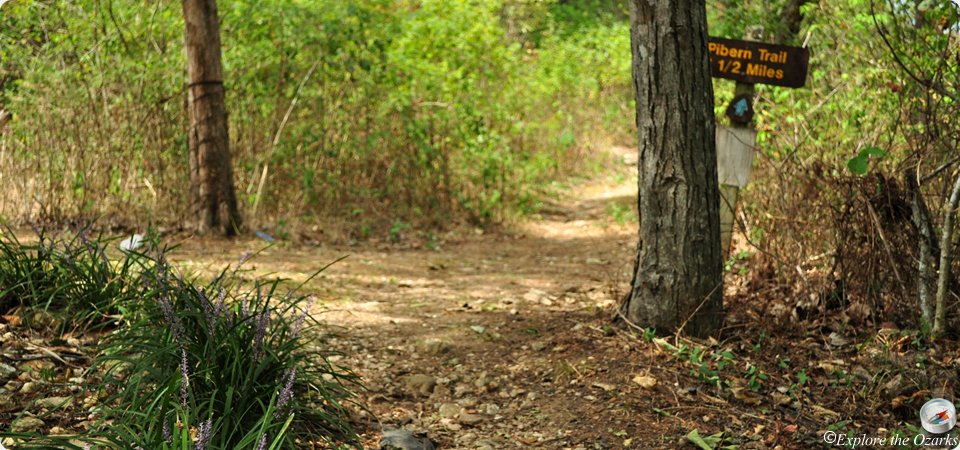
Pibern Trail
- The Basics
- Type: Hiking
- Length: 1½ miles Loop
- Difficulty: Moderate
- Time: 1 hour - 1½ hours
- Requirements: None
- Description
- Traveling from the campground, to the top of the ridge, then back down again, hikers along this trail will discover a variety of different habitats & features typically found in the Ozarks; dry hardwood forests, moist limestone & dolomite glades, tall bluffs, north and south facing hillsides, rock outcropings, karst topography, and Ozarks streams.
- Additional Info
- Camping: No
- Water: No water on trail
- Trail Head(s): North end of Campground 1
- Trail Markings: Orange Arrows
- Pets Allowed:
- Recommended Season:
River Trail
- The Basics
- Type: Hiking
- Length: 0.7 miles One-Way
- Difficulty: Easy - Moderate
- Time: ½ hour
- Requirements: None
- Description
- Following Roaring River, this trail will take hikers from the CCC Lodge to Campground 3, and vice versa. Wildflowers are abundant along this trail in the spring. The hike is short, but you do have to cross Hwy F to get from the lodge to the campground. Use caution.
- Additional Info
- Camping: No
- Water: No water on trail
- Trail Head(s): CCC Lodge; Campground 3
- Trail Markings:
- Pets Allowed:
- Recommended Season:
Springhouse Trail
- The Basics
- Type: Hiking
- Length: ½ mile Loop
- Difficulty: Easy - Moderate
- Time: ½ hour
- Requirements: None
- Description
- Leading hikers through a dry-mesic forest, this trail passes by an old homestead site, and near the springhouse that was used to keep food and dairy products cool, using the natural cooling temp of the spring water that flowed from the rock.
- Additional Info
- Camping: No
- Water: No water on trail
- Trail Head(s): Emory Melton Inn parking lot
- Trail Markings:
- Pets Allowed:
- Recommended Season: