


The Basics
Richland Creek Wilderness Area
Ben Hur & Pelsor/Sand Gap, AR
Phone: (479) 284-3150 (Big Piney District Office)
Closest Towns: Ben Hur, Jasper, Marshall, Pelsor/Sand Gap
Directions: Richland Campground-North Approach: Take AR Hwy 123 East from Lurton, which is about 26 miles south of Jasper on Scenic Hwy 7, between Pelsor/Sand Gap and Cowell. Go 1.5 miles, then Turn Right onto FR# 1200/CR# 36. Travel 6.8 miles, then Continue Straight/Turn Right onto FR# 1205/CR# 37. Go another 1.6 miles to a four way junction of sorts. This is Iceledo Gap (turning right leads to the Hill Cemetery Access). Continue Straight for another 6.7 miles, and the campground entrance will be on your right, just after you cross a bridge over Richland Creek.
Richland Campground-South Approach: From the intersection of AR Hwy 7/16/123 at Pelsor/Sand Gap, head East on Hwy 16 approx. 9.8 miles, just past the small community of Ben Hur, to FR# 1205/CR# 68/Upper Falling Water Rd. Turn Left and go about 10 miles to the campground entrance on your left.
Hill Cemetery Access: Take AR Hwy 123 East from Lurton, which is about 26 miles south of Jasper on Scenic Hwy 7, between Pelsor/Sand Gap and Cowell. Go 1.5 miles, then Turn Right onto FR# 1200/CR# 36. Travel 6.8 miles, then Continue Straight/Turn Right onto FR# 1205/CR# 37. Go another 1.6 miles to a four way junction of sorts. This is Iceledo Gap. Turn Right onto what appears a driveway, drive down the hill and past the house, then across a small stream. The road will end after 0.8 miles at Hill Cemetery. The first part of this road passes through private property, so be sure to not tresspass. Also, the road is starting to get rough in places, and a high clearance vehicle may be needed.
About Richland Creek Wilderness Area
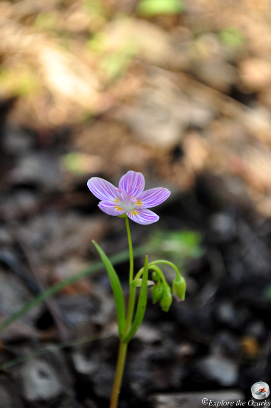
Located deep in the Ozark National Forest, miles from civilization, and home to hiking trails, swimming holes, cascades and waterfalls, wildflowers, fall color, bluffs, rock formations and so much more, the Richland Creek Wilderness Area is one the most scenic areas in all of the Ozarks or Ouachitas. Designated by Congress in 1984, this Wilderness Area offers 11,801 acres of the most rugged and scenic beauty of the Boston Mountains, and is one of four wilderness areas located within the Big Piney Ranger District.
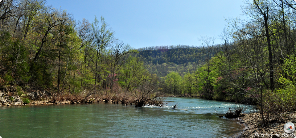
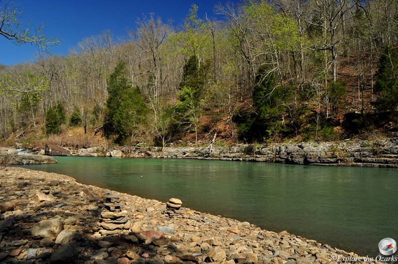
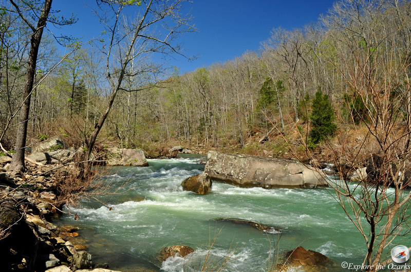
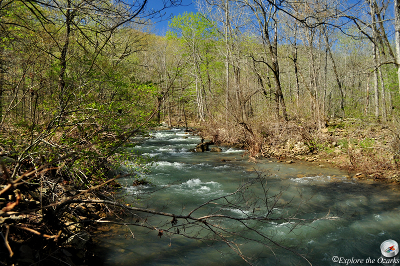
The area gets its name from the main drainage that runs through it, Richland Creek. Popular with kayakers, Richland Creek is very scenic, especially in the spring and fall. Large boulders and rocks dot the creek, creating many scenic pools and rapids. Near the campground, there is also a good swimming area, although just about anywhere up or down the creek would be good for swimming.
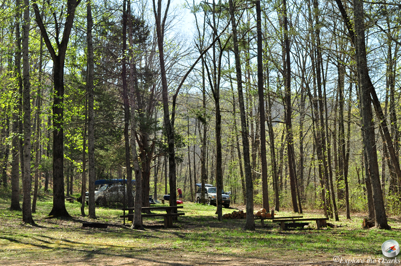
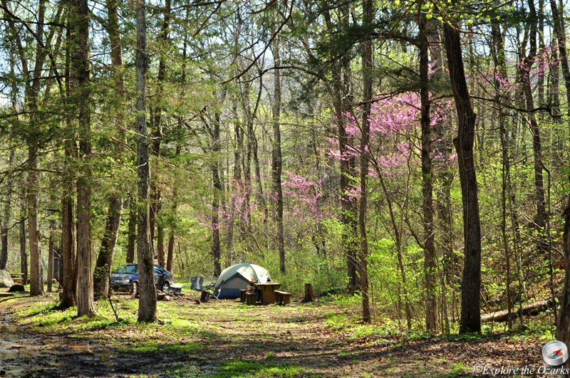
On the East end of the wilderness area, just outside the official boundary, sits Richland Creek Campground, located along FR# 1205/Falling Water Road. This campground is the main access for the wilderness area, and offers 11 designated primitive campsites. From the campground, a "user-created" trail takes off to the west into the heart of the wilderness, and provides access to the most popular features of the Richland Creek Wilderness Area, Twin Falls and Richland Falls. Twin Falls and Richland Falls can be accessed either from the campground or from the Hill Cemetery access. Another major waterfall near these two is Hamilton Falls, definitely worth the side trip. Of course, when the water is up after a good rain, there are countless other smaller waterfalls in most of the other side drainages throughout the wilderness area.
While there are no designated trails within the wilderness area, many old logging roads from years past cross the area, and many people follow these to access the area. Other "user-created" trails that have been beaten over time can be found as well. Skirting the outside southern and eastern edges of the wilderness area is the Ozark Highlands Trails, which can also be accessed from the Richland Creek Campground.
Other scenic areas within the Richland Creek Wilderness Area that can be viewed include Fuzzybutt Falls, Horsetail Falls, Intersection Falls, Keefe Falls, and Six Finger Falls, all of which can be accessed from FR#1205/Falling Water Road south of the campground.
Features
Campground | Fuzzybutt Falls | Hamilton Falls | Horsetail Falls | Intersection Falls | Keefe Falls | Richland Falls | Six Finger Falls | Twin Falls of Richland | Sandstone Castle
What's Nearby
Parks & Nature
Pedestal Rocks Scenic Area
Trails
Pedestal Rocks/Kings Bluff Trails
Camping
Fairview Campground
Richland Creek Campground
Lodging
Local Eateries
Gear & Supplies
Other Attractions
Falling Water Falls
Ft. Douglas/Hwy 123 Access
Kings Bluff Falls
Six Finger Falls
Towns & Cities