


The Basics
Flatside Pinnacle
Ouachita National forest
Phone: (501) 984-5313 (Jessieville District Office)
Closest Towns: Jessieville, Morrilton, Ola, Perryville
Directions: From the Jessieville Ranger Office, head North on AR Scenic Highway 7 for about 13 miles, just past the South Fourche Campground, and Turn Right onto FR#86/CR#39. Reset your odometer, then follow this gravel road East for approx. 9.4 miles to a 5-way intersection. Keep to the Right, turning onto FR#94/CR#53. Keeping Right at approx. 11.8, continue to follow FR#94 until you reach the parking area on your Right at approx. 12.2 miles.
About Flatside Pinnacle
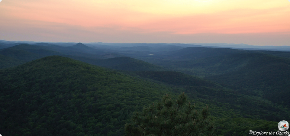
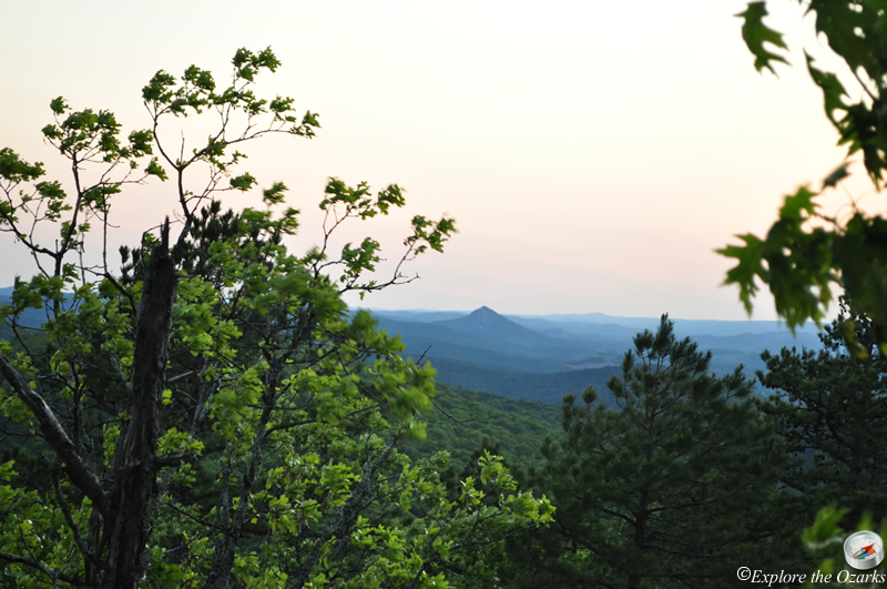
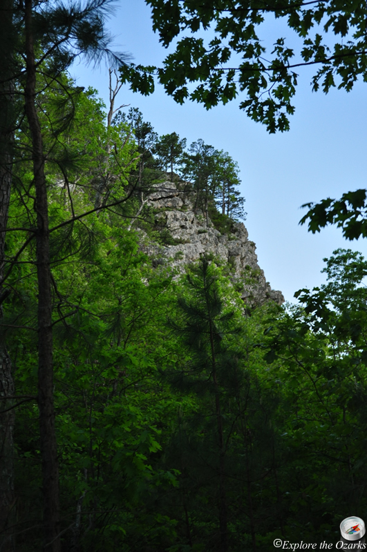
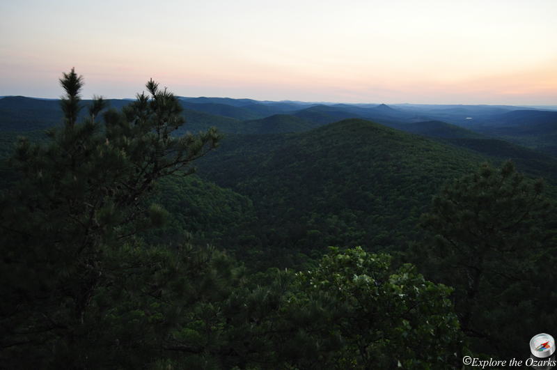
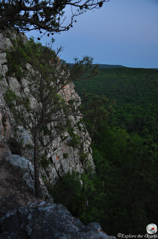
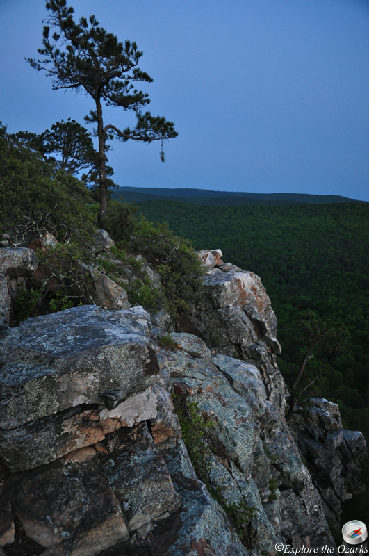
Located just outside the Flatside Wilderness, and located along the Ouachita National Recreation Trail, the Flatside Pinnacle is a 1,550 mountain peak/rock outcrop that, when you climb to the top via a short but steep trail, offers one of the best sunset views in the enitre Ouachita Mountains.
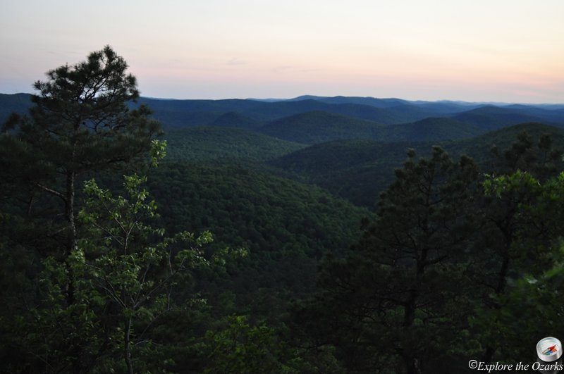
From the top, views span all the way across the Flatside Wilderness, offering sights such as Forked Mountain and White Oak Mountain, which is the tallest peak within the Flatside Wilderness. The forested ridges and valleys seem unbroken all the way towards to horizon, and the fall colors from up here can be absoultely spectacular. Spring time also offers an abundance of wildflowers, and offers the best chance for exploring nearby waterfalls as well.
What's Nearby
Parks & Nature
Flatside Wilderness Area
Trails
Bear Creek Equestrian Trails
Camping
Bear Creek Horse Camp
Lake Sylvia Campground
South Fourche Campground
Lodging
Local Eateries
Gear & Supplies
Other Attractions
Brown Creek Cascade
Chinquapin Mountain Walk-In Turkey Hunting Area
Deckard Mountain Walk-In Turkey Hunting Area
Forked Mountain Falls
Iron Springs Picnic Area
Twist Cascade
Towns & Cities