


The Basics
Alum Cove Natural Bridge Geologic Area
Jasper, AR
Phone: (479) 284-3150 (Big Piney District Office)
Brochure: Alum Cove Natural Bridge (courtesy USFS)
Closest Towns: Jasper, Pelsor, Ponca
Directions: From Jasper, start out heading West on Hwy 74 from Hwy 7. Just before Hwy 74 heads uphill, take the Left onto Hwy 327. Follow Hwy 327 South for approx. 14.5 miles, through the small community of Wayton and into the National Forest. The turn off will be on your left. You can also get here by heading South out of Jasper on AR Scenic Hwy 7 for approx. 14.5 miles to Hwy 16. Turn Right onto Hwy 16, and go approx. 1.1 miles to CR# 28. Turn Right and go approx. 3 miles to the turn off on your Right.
About Alum Cove Natural Bridge
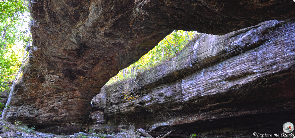
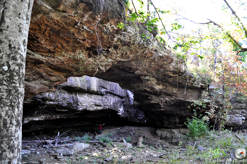
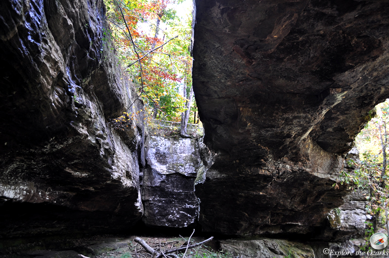
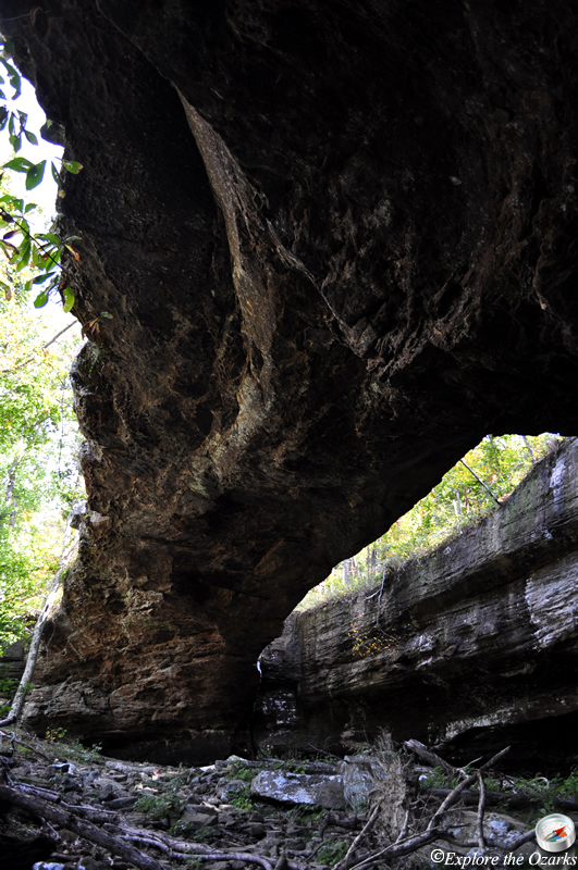
One of the most unique geologic features in the Ozark National Forest is the natural stone arch bridge at Alum Cove. Formed from the remains of a quartz sandstone cave, over time wind, water and ice weathered the opening between the arch and the rock overhang. The arch spans 130 feet, and is 20 feet wide.
Early settlers are said to have used this natural bridge to cross the streambead during rainy weather as they moved their wagons, livestock or logged the surrounding rugged hills. Native Americans even used the overhang as shelter on hunting trips, as well as some of the other caves and formations along the bluffline across the cove.
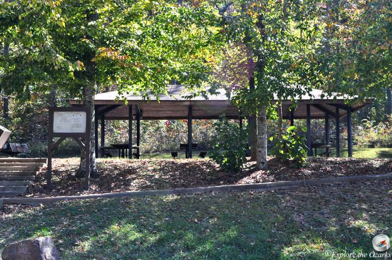
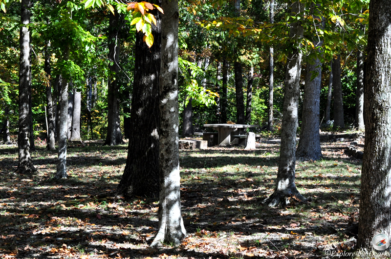
Alum Cove Natural Bridge Geologic Area is a day-use only area, offering 7 picnic sites, a group pavilion, vault toilet, and seasonal water, typically available from April thru September. No camping is allowed in the area or anywhere near the natural bridge.
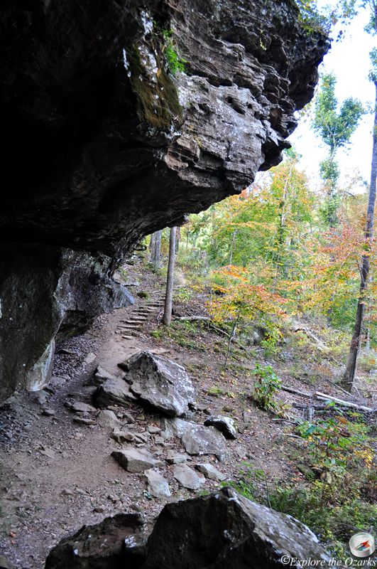
The 1.1 mile Alum Cove National Recreation Trail offers access and views of the arch. This trail is a loop trail, beginning and ending at the picnic area. The first 0.4 mile of the trail leads downhill to the top of the natural bridge, offering a unique perspective from above. From either side of the bridge, the trail continues down below for an even closer look at the arch and overhang. After viewing the arch, you can return back, or continue along the looped trail, which descends below the arch, across a small stream, then along the bluffs across the cove, eventually returning back to the natural bridge. Allow approx. 1 hour to complete the entire trail loop.
What's Nearby
Parks & Nature
Trails
Camping
Lodging
Local Eateries
Gear & Supplies
Other Attractions
Towns & Cities