


The Basics
Eleven Point National Scenic River
c/o Mark Twain National Forest
Eleven Point Ranger District
#4 Confederate Ridge Rd.
Doniphan, MO 63935
Phone: (573) 996-2153 (Eleven Point District Office)
Closest Towns: Alton, Doniphan, Thomasville, Winona
About Eleven Point River
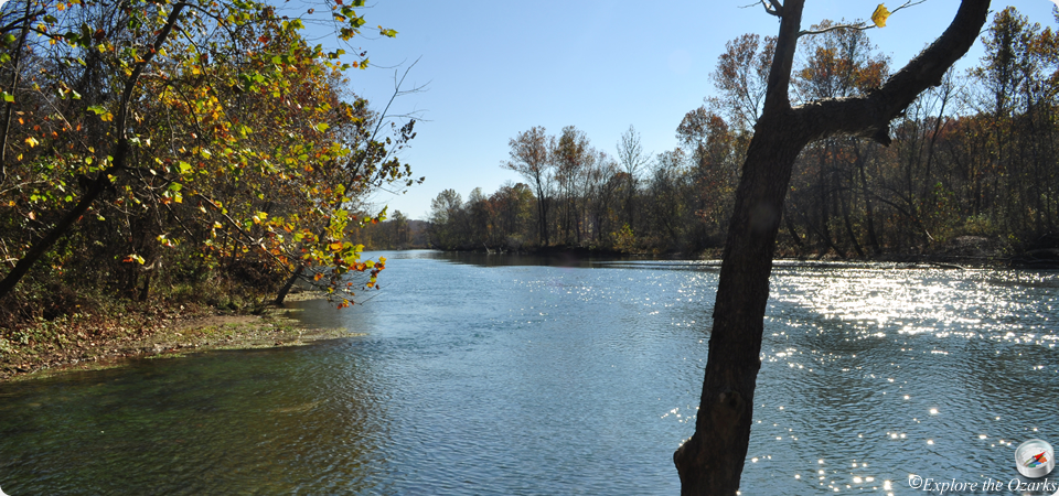
In 1968, when congress established the National Wild & Scenic Rivers System, a 44-mile portion of the Eleven Point River in southern Missouri qualified as a National Scenic River. Free of impoundments, and possesing a largely undeveloped watershed or shoreline, this portion of the river between Thomasville, Missouri downstream to the Highway 142 bridge became one of the 8 initial units of the NWSR system in 1968.
Starting as merely a small stream at its upper reaches near Thomasville, the Eleven Point quickly gains depth and width as it flows first east, then turns south towards Arkansas. Numerous springs pour into the river from dolomite bluffs or up from vast underground systems. These springs provide a continuous source of water and natural beauty to the river and surrounding area. One such spring is Greer Spring, which is the second largest spring in Missouri. Emerging a little over a mile away, as the waters of Greer Spring enter the Eleven Point River, it actually doubles the size of the river. This allows the river below the spring branch to be floatable year-round, even during dry years.
Several access and recreation points can be found along the river. Ten access points provide a put-in or take-out place for floaters, including Greer Crossing Recreation Area, which is a National Forest campground. Also along the river, floaters will find 7 designated float camps, accessible only from the river. These float camps provide a table, latrine, and fire ring. Although these float camps exist, floaters are also allowed to camp along gravel bars and river banks. No camping is allowed on scenic easements, which are private property.
* About half of the lands along the Eleven Point National Scenic River are private lands, with the remainder of the area belonging to the Mark Twain National Forest, Eleven Point Ranger District. The private lands along the river are managed by scenic easements to assure protection of their scenic values and natural resources. Public entry onto private land is prohibited. Be sure to study the river map and be alert for private property or scenic easement signs located along the river to avoid trespassing. *
Features & Facilities
- Boomhole Access
- Cane Bluff Access
- McDowell Access
- Riverton Access
- The Narrows Access
- Thomasville Access
- Turner Mill Access (North)
- Turner Mill Access (South)
- Whitten Access
- Barn Hollow Float Camp
- Boze Mill Float Camp
- Greenbriar Float Camp
- Horseshoe Bend Float Camp
- Morgan Spring Float Camp
- Stinking Pond Float Camp
- Whites Creek Float Camp
- Greer Crossing Rec Area
Access Points
Float Camps
Campgrounds
What's Nearby
Parks & Nature
Trails
Camping
Lodging
Local Eateries
Gear & Supplies
Other Attractions
Towns & Cities